Located at the southernmost tip of the Fatherland, Cape Ca Mau stands tall as an unmatched coordinate on Vietnam’s S-shaped map, where the national sovereignty marker designates the sacred southernmost point of the motherland. Blessed with a prime geographic location featuring unique latitude and longitude coordinates, this is the only place on mainland Vietnam where visitors can watch the sun rise over the East Sea and set into the West Sea. The geomantic terrain of Cape Ca Mau bears the magnificent imprint of harmony between continent and ocean, embraced by an intricate network of rivers, winding tidal creeks, and vast, endless mangrove and cajuput forests. The relentless alluvial accretion of the Mekong River combined with the currents of the East and West Seas has forged a young, dynamic land that continually reaches out into the open ocean, carrying priceless geological and ecological heritage values deeply cherished by both domestic and international authorities and media.
Turning back the pages of time to the past, the historical origins and name of this land are closely tied to the arduous yet heroic southern reclamation campaign of Vietnam’s ancestors. Dating back to prehistoric times and the Funan era, the footprints of the Oc Eo culture inhabitants from the 1st to the 7th centuries were left behind across archaeological sites scattered throughout the southwestern region, testifying to an indigenous civilization that once ventured out to sea. Entering the land-reclamation period under the Nguyen Dynasty—particularly from the 17th to the 19th centuries under the Nguyen Lords and the independent Nguyen Dynasty—Ca Mau was gradually integrated into the national administrative map. The Dai Nam Nhat Thong Chi (Comprehensive Gazetteer of Dai Nam), compiled by the National Historiographer’s Office of the Nguyen Dynasty, once described this southernmost frontier as a steadfast strategic bulwark of the nation. Through the turbulent vicissitudes of history, from the French colonial era when it was placed under the administration of Bac Lieu Province to the re-establishment of An Xuyen Province, the name Cape Ca Mau has retained its sacred place in the Vietnamese consciousness.
The journey of forming and safeguarding this land cannot be separated from the legacies of outstanding historical figures and cultural luminaries. It owes much to the pioneering territorial expansion of Admiral Mac Cuu and the Mac clan from the late 17th century, who laid a solid foundation for establishing the sovereignty of the Dai Viet court over Ha Tien and the Ca Mau Peninsula. Carrying that tradition forward into the era of resistance against foreign invaders, Cape Ca Mau and the Nam Can mangrove forest system became a resilient revolutionary base, sheltering generations of insurgents and patriotic scholars during the Can Vuong movement as well as the nation’s protracted resistance wars. The convergence of its singular geographic position, magnificent ecological terrain, and profound historical and cultural depth has transformed Cape Ca Mau into an immortal symbol of patriotism, self-reliance, and fierce pride in the sacred maritime sovereignty of the Vietnamese nation.
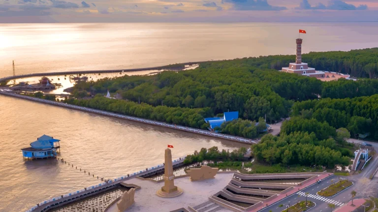
Stepping away from the heroic historical chronicles of land reclamation and resistance, Cape Ca Mau emerges as a magnificent natural masterpiece at the edge of the Fatherland, where the mainland blends seamlessly into the boundless expanse of sea, sky, and water. Shaped by the intense alluvial deposition of the Mekong River, the landmass takes the form of a ship’s prow surging out to cleave the open waves, standing proud and resilient against the ocean winds across all four seasons. The natural scenery here is an untamed yet soulful fusion of vast primeval mangrove ecosystems and an intricate web of lagoons and estuaries. Endless stretches of mangrove and cajuput trees, with their extraordinary stilt roots anchored deep into the earth, do far more than serve as a “green wall” protecting the mainland—they create a remarkably unique natural architectural space where humans feel humbled before the immensity of the southern wilderness.
The most iconic architectural highlights here are the Cape Ca Mau Welcome Gate and the Ship Monument cleaving the waves toward the East Sea, alongside the intricately sculpted National Coordinate Marker GPS 0001. Designed with soaring architectural blocks, the Ship Monument emulates the prow of a vessel braving high seas, embodying the aspirations and indomitable willpower of the Vietnamese people. Surrounding the monument area, supporting structures such as the Ho Chi Minh Trail terminus milestone, the multi-story observation tower, and the memorial house are thoughtfully planned, harmoniously blending modern materials with local cultural resonance. Every architectural detail, from seagull-wing bas-reliefs to landscaped miniature gardens, celebrates the proud beauty of the cape region, forming an architectural complex that is both solemn and poetic amid majestic nature.
To capture the full million-dollar beauty of this region, professional photographers and travel journalists always share two classic, unmissable camera angles. The first is right within the grounds of National Coordinate Marker GPS 0001, framed together with the iconic Ship Monument; the ideal time is at dawn (from 5:30 AM to 6:30 AM), when the first golden rays of sunlight pierce through the thin morning mist, tinting a corner of the East Sea pink and creating a truly ethereal, sacred lighting effect. The second angle is atop the high-rise observation tower offering panoramic views over the Nam Can mangrove forest and the boundless sea; sunset (from 5:00 PM to 6:00 PM) is the “golden hour” for capturing breathtaking shots, as the sky over Cape Ca Mau shifts from brilliant orange to deep violet, reflecting off the mirror-smooth water and leaving an unforgettable, lingering emotion in everyone who sets foot here.
As your boat cuts through the waves and glides along a labyrinth of canals deep into the core zone of Cape Ca Mau National Park, an untamed and majestic natural world suddenly unfolds before your eyes, offering travelers priceless real-world experiences found nowhere else. Without towering, perilous mountain ranges to climb, the true essence of conquering the southernmost tip of the Fatherland lies in traversing vast mangrove forests, where mangrove and cajuput ecosystems rise vigorously amid endless waves. Riding a traditional vo lai motorboat down silt-laden red waters, listening to the brisk sea breeze mingle with the symphony of thousands of birds and storks calling to their flocks, visitors feel transported back to the pristine wilderness of the pioneering era, experiencing firsthand the fierce vitality surging from alluvial mudflats that expand into the sea year-round.
Standing before the southernmost coordinate marker GPS 0001 rising proudly between earth and sky, every visitor’s heart swells with indescribable pride. Gazing out into the distance, the expansive waters of the East Sea and the Gulf of Thailand merge into one, painting a grand natural tableau with a curving horizon embracing the S-shaped land. Within this sacred space, travelers can pause to pay respects at the Ship Monument complex or the Temple of Lac Long Quan and Mother Au Co, a sanctuary preserving the sacred spirit of the land and honoring Vietnam’s forebears. In the quiet moment of lighting an incense stick facing the southern tip of the Fatherland, the heart grows remarkably still, clearly feeling every pulse of history intertwining with the present and leaving a deeply moving sense of awe at the enduring beauty of the nation.
A journey to explore Cape Ca Mau would never be complete without savoring the rich, authentic flavors of southern local cuisine. Right amid a lush garden setting swept by ocean breezes, visitors can indulge in rustic yet far-famed specialties such as U Minh fermented fish hotpot fragrant with lemongrass, chili, and crisp wild vegetables; firm, sweet Ca Mau mud crab bursting with rich coral roe; or salt-and-chili grilled mudskipper infused with the savory tang of the sea. Every dish is not merely a crystallization of nature’s freshest bounty, but also carries the sincerity, simplicity, and warm hospitality of the people of Dat Mui. Bidding farewell to Cape Ca Mau, carrying the lingering echoes of vivid experiences and heartfelt local warmth, travelers will forever hold in their hearts the image of a resilient, expansive, and heart-stirringly beautiful southernmost land.
Cape Ca Mau, the sacred southernmost tip of the Fatherland, has always been an aspirational destination for those who love exploring the country. To ensure your journey to the southernmost edge of Vietnam goes as smoothly and fulfilling as possible, travelers should equip themselves with practical tips regarding timing, costs, travel routes, and appropriate attire suited to the unique mangrove terrain.
Regarding the ideal time to visit, the dry season from December to April of the following year is considered the absolute best window. During these months, Ca Mau enjoys sunny, dry weather with little rain and calm seas, making travel by speedboat or high-speed ferry to the coordinate landmarks effortless while allowing visitors to take in breathtaking sunrises and sunsets over the ocean.
The Cape Ca Mau Coordinate Marker area and the Cape Ca Mau Cultural and Tourism Park welcome visitors every day of the week, opening from early morning at around 7:00 AM until 5:00 PM. Currently, admission tickets to the tourist site follow standard local listed rates (typically around 30,000 VND per adult), while children and eligible policy beneficiaries receive exemptions or discounts in accordance with current regulations. Visitors are advised to carry small-denomination cash on hand for convenient ticket purchases and accompanying services.
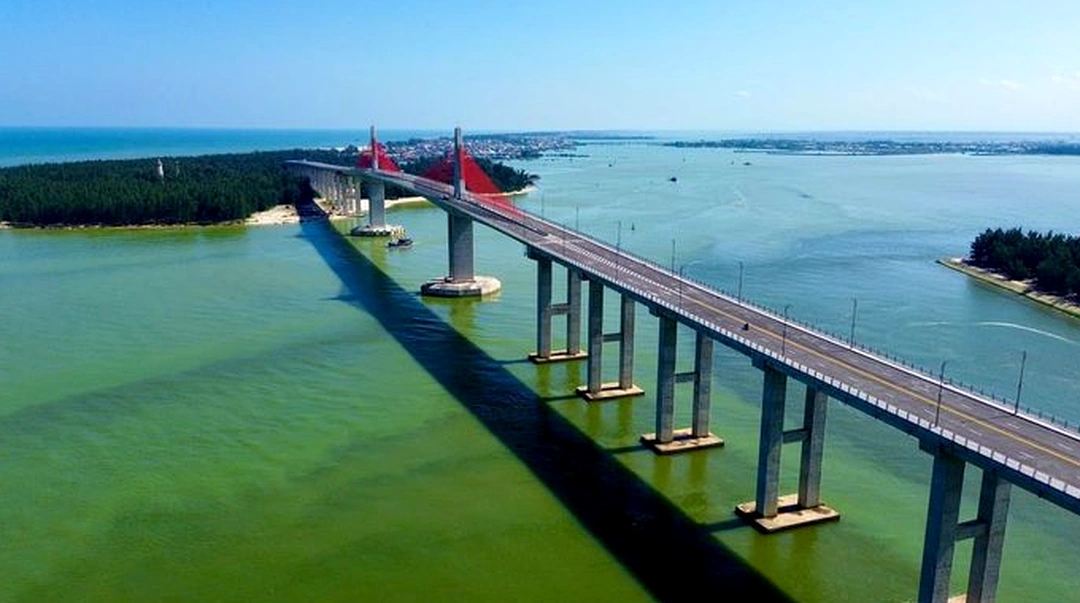
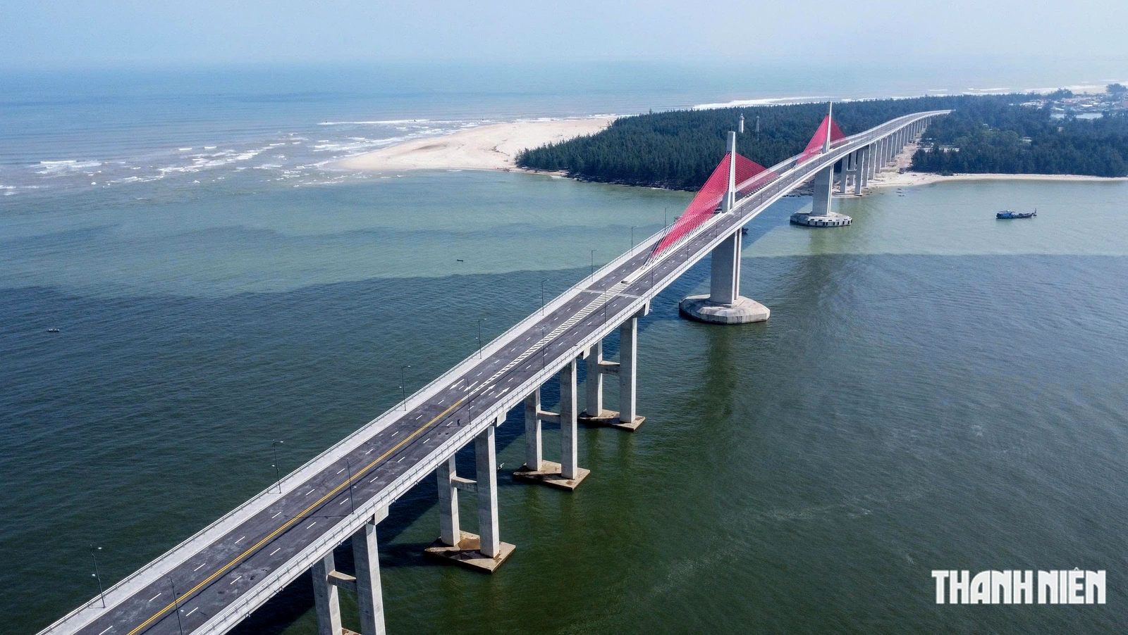
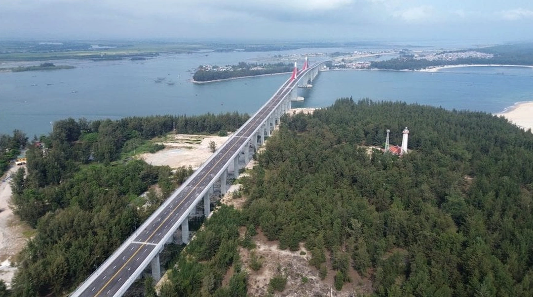
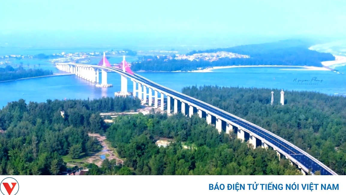
As for transportation and routes, from the center of Ca Mau City, travelers can choose to travel by motorbike, intercity coach, or taxi along National Highway 1A toward Nam Can District, then continue across the Nam Can Bridge into Dat Mui. The overland highway is now paved, spacious, and easy to navigate. In particular, from central Dat Mui, if you want an exhilarating thrill and a closer look at the primeval mangrove ecosystem, you can hire a high-speed canoe to skim across the waves through winding creeks straight to the Ship Monument.
Finally, given that Cape Ca Mau features wetlands, coastal mudflats, and spiritual temples, visitors should prioritize neat, breathable, sweat-wicking clothing along with sneakers or non-slip flat shoes for comfortable walking and climbing the observation tower. When entering spiritual cultural spaces or temples, please dress politely and modestly, maintaining a respectful and civilized demeanor to preserve the solemnity of the historical grounds and natural scenery at the windswept frontier.
To enjoy a seamless getaway and take in the full splendor of Cape Ca Mau without worrying about arranging transportation, booking entrance tickets, or planning itineraries, travelers can choose VDS Travel’s premium all-inclusive Ca Mau tour packages. Every itinerary is thoughtfully designed to optimize photo check-in times when the scenery is at its most radiant, accompanied by knowledgeable local guides and top-tier hotel and dining standards.