Located at the very end of the S-shaped strip of land, where “raging waves surround, and the mainland stretches out to the vast ocean,” the National GPS 0001 Coordinate Marker at Dat Mui, Ca Mau emerges as a sacred symbol of national sovereignty and a testament to the aspiration of extending the national territory. Situated at the sacred southernmost point of the Fatherland, the marker bears a special geodetic coordinate system, marking the wondrous confluence point of the mainland, high skies, and boundless ocean. The local terrain carries the deep feng shui imprint of a water-gathering land, accreted from the alluvial deposits of major rivers flowing into the East Sea and the Gulf of Thailand, creating a one-of-a-kind pristine mangrove ecosystem. The constant shifting of coastal alluvial flats further highlights the dynamic beauty of a living geographical entity, where new land continuously reaches out to expand the survival space for the nation.
Looking back through time, the history of formation and naming of the Mui land is intertwined with the arduous yet heroic southern pioneering process of our ancestors. In its early days, this land consisted of wild mangrove cajeput and mangrove apple forests, once bearing the footsteps of generations of residents dating back to the ancient Oc Eo culture. By 1698, when General Nguyen Huu Canh, obeying the order of Lord Nguyen Phuc Chu, went south to establish Gia Dinh prefecture, administrative sovereignty was officially established over the land bearing the original Khmer name “Tuk Khmau”—meaning black water, recalling the characteristic water color of the U Minh cajeput forest ecosystem and rivers heavy with silt. Under the Nguyen dynasty, especially in the 17th year of Minh Mang (1836), through standard geographical maps and land registry systems, the imperial court officially recognized Cape Ca Mau as the southernmost extremity of Dai Nam’s territory, affirming the strategic stature of this frontier region.
Inheriting this historical stream, the National GPS 0001 Coordinate Marker was born during the Doi Moi (Renewal) period as a modern milestone connecting a heroic past with a future of integration. Commenced on January 1, 1995, and solemnly inaugurated on May 19, 1999, to commemorate the 109th birthday of President Ho Chi Minh, the project represents the dedication of central and local agencies to affirm national sovereignty on global coordinates. Under the lens of heritage travel culture, the marker is not purely a check-in destination carrying the spiritual significance of millions of Vietnamese hearts turning toward the southernmost region, but simultaneously a living museum of geological science and the history of exploration. Standing before the GPS 0001 marker, amidst the millennia-old sound of waves and the fluttering flag of the Fatherland, every traveler deeply feels national pride, respect for the value of peace, and a sacred love for every inch of their homeland.

Standing proudly amidst the vast expanse of the southern skies and earth, the National GPS 0001 Coordinate Marker at Dat Mui, Ca Mau is not merely a sacred symbol of national sovereignty but also an architectural masterpiece that blends completely with the most majestic natural landscape in the Mekong Delta. The project makes a strong visual impression at first sight thanks to its unique terrain, located right at the edge of the pristine mangrove forest facing the turbulent waters of the East Sea and the Gulf of Thailand. Every architectural line of the marker bears a modern style deeply imbued with national identity, featuring a sturdy block design with finely chiseled, solemn, and majestic angles. The prominent sculptural highlight on the body of the marker is the symbol of a ship cutting through the waves with a high-reaching bright red sail, symbolizing the resilient will, the aspiration to rise up and conquer the ocean, and the spirit of protecting the maritime sovereignty of the Vietnamese nation through generations.
Surrounding the marker is the wild, majestic, and poetic painting of the Ca Mau Cape National Park. This place possesses a rich mangrove ecosystem with intertwined red mangrove and white mangrove roots, reaching out vigorously amidst fertile alluvial mudflats. Standing in the courtyard of the GPS 0001 coordinate marker, visitors can gaze out at the boundless expanse of water, listen to the roaring sea breeze blowing through the emerald-green forest canopy, and enjoy the fresh, open atmosphere rich with the salty flavor of the ocean. The perfect combination of architectural work bearing modern historical imprints and the one-of-a-kind mangrove forest-sea ecosystem has turned this place into an ideal stopping point, evoking intense national pride in the heart of every Vietnamese person.
To preserve the most exquisite moments in this sacred southernmost land, professional photographers and travel journalism circles frequently pass around artistic “million-view” shooting angles. The first angle evaluated as the highest quality is directed from the long pier stretching out into the sea looking back toward the shore; from this perspective, the entire shape of the sail monument and the GPS 0001 marker emerges towering and majestic amidst the vast seascape and sky, creating a grand sense of depth for the photograph. The second angle is a close-up shot of the intricate carving details of the marker combined with a background of deep green mangrove forests in the distance, bringing a peaceful yet extremely sturdy feeling. The third unmissable angle is a panoramic shot from above using a flycam device, encompassing the fan-shaped cape image day and night encroaching upon the sea, affirming the immutable sovereignty of the Fatherland.
Regarding the ideal lighting times for photography, sunrise and sunset are the two “golden” moments hunted most by camera operators. At sunrise, as the early day’s rays slowly break across the horizon of the East Sea, the entire Dat Mui space is dyed a magical pink-orange hue, casting brilliant radiances onto the body of the marker, awakening an expansive ecological region full of vitality. Conversely, when sunset falls, the blazing red sun slowly sinks into the waters of the Gulf of Thailand, creating a solemn, romantic, and extremely majestic space. The angled natural lighting combined with constantly changing sky clouds at this moment will act as the perfect catalyst for visitors and photographers to create lifetime artistic works, recording the complete journey of conquering the sacred southernmost point of the Fatherland.
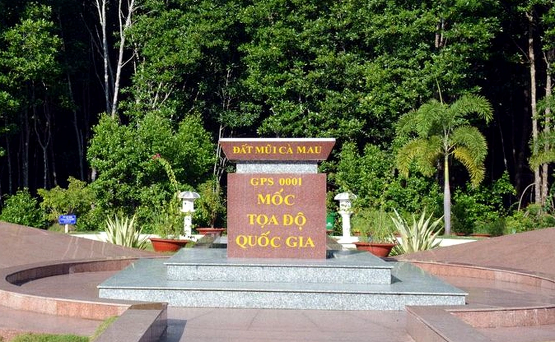
Setting foot in the southernmost part of the Fatherland, the journey to conquer the National GPS 0001 Coordinate Marker is not merely a geographical shift but also a sacred reunion with history and the spiritual soul of mountains and rivers. The most valuable practical experience for any traveler coming here is the feeling of walking amidst the boundless expanse of earth and sky, where the boundary between the mainland and the open sea seems to blur, leaving only the sound of murmuring waves and the salty breeze of the ocean.
The journey to explore Ca Mau Cape becomes even more complete when visitors drift along on “vo lai” motorized wooden boats—the characteristic transportation of the western river region—gliding through the boundless pristine mangrove ecosystem. Sitting on a small boat weaving through red alluvial waters, threading between towering red and white mangrove trees burying their roots deep into the earth, you will clearly perceive the vibrant vitality of a young land day and night accreting toward the open sea. The wild, majestic natural landscape unfolds before your eyes with high skies and freely soaring birds, bringing a wonderfully relaxed and peaceful feeling.
When approaching the area of the GPS 0001 project, standing beneath the shade of the ship symbol reaching out to the open sea, the emotion in the heart of every visitor suddenly bursts. Touching the national coordinate marker—marking the southernmost extremity on the mainland—the awe before the open space gives way to surging national pride. Gazing out from the towering observation tower, the entire cape land emerges completely in a breathtaking natural painting: on one side, the East Sea rolls with crashing waves, while on the other, the Gulf of Thailand is gentle and calm. The moment of standing before the sacred marker, watching the red flag with a golden star fluttering in the sea breeze, everyone’s soul seems to settle, raising deep gratitude toward ancestral generations who pioneered, preserved, and protected every sacred inch of the Fatherland’s land.
Not only touching the sublime emotions of reason and soul, the journey at Dat Mui also awakens all the senses of travelers through an extremely rich and widely renowned local cuisine. After moments of strolling and exploration, enjoying specialty dishes carrying the rich flavor of the mangrove region is an unforgettable experience. You will taste the rich flavor of U Minh fermented fish hotpot fragrant with wild field herbs, solid Ca Mau crabs with sweet red roe, or mudskipper grilled with chili salt imbued with sea flavor, alongside fatty young bee larva salad. Each dish embodies the rustic, hospitable, and welcoming nature of the people in the southernmost region.
Concluding the experiential journey at the National GPS 0001 Coordinate Marker, visitors not only carry away beautiful commemorative photos but also retain in their hearts an indescribable pride. Ca Mau Cape, with the wild beauty of nature, the warmth of human affection, and historical and sacred sovereign values, will forever remain an unforgettable mark in the minds of anyone who has ever stepped foot there.
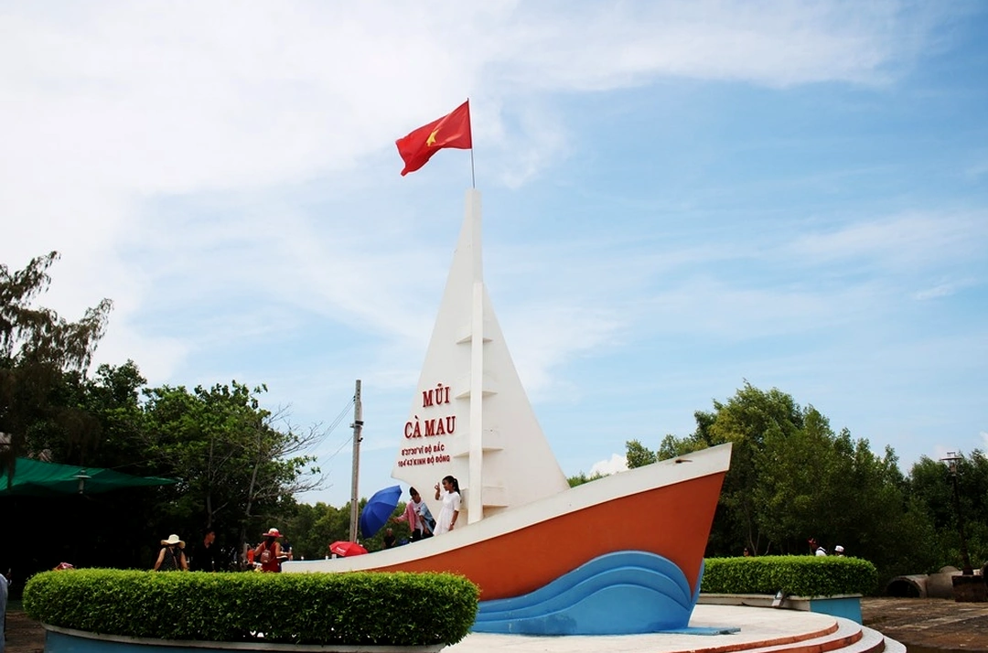
The National GPS 0001 Coordinate Marker at Dat Mui, Ca Mau is not simply a sacred stop marking the southernmost tip of the Fatherland but also the coveted coordinate of every Vietnamese person. To ensure your journey exploring this southernmost land of the Fatherland is complete and smooth, the pocket guide below will provide the most practical and detailed information for travelers.
Regarding operating hours, the National GPS 0001 Coordinate Marker area within the Ca Mau Cape National Tourist Area is open to welcome visitors every day of the week, including holidays and Tet. Tourist service hours typically begin from early morning around 7:00 AM to 5:00 PM daily, creating favorable conditions for visitors to proactively schedule their travel itineraries and catch the sunrise or sunset over the sea.
Good news for all travelers is that currently, when entering the Ca Mau Cape National Tourist Area to check in beside the GPS 0001 Coordinate Marker and the Dat Mui ship symbol, visitors enjoy free admission to the coordinate marker area itself. You only need to purchase an entrance ticket to the tourist area at a very affordable price according to the province’s general regulations to support landscape preservation efforts, or purchase canoe/speedboat tickets if choosing water transportation.
The distance from the center of Ca Mau city to Dat Mui is over one hundred kilometers. Travelers can choose to travel by motorbike, private car, or passenger bus along the completed, smooth Nam Ca Mau paved route cutting through vast mangrove forests. Additionally, the experience of taking a high-speed canoe departing from the Ca Mau city boat pier crossing the river network and sea mouths to arrive directly at Dat Mui is also an extremely interesting option, providing a vivid perspective on the southern mangrove ecosystem.
The ideal time of year to visit the National GPS 0001 Coordinate Marker is from October to April of the following year. This is the dry season in the West, featuring sunny weather with little rain and calm seas, favorable for taking commemorative photos and participating in mangrove forest ecosystem exploration activities. Regarding attire, since this is a spiritual cultural space carrying sacred national sovereignty significance and the terrain includes several walking sections and coastal wooden bridges, visitors should prioritize neat, polite, and modest clothing; while wearing sneakers or slip-resistant flat shoes to easily move around and capture the most beautiful frames beside the sacred coordinate marker.
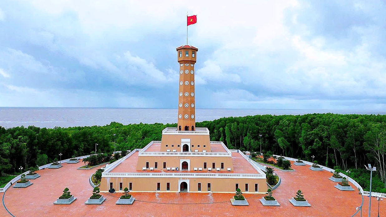
To enjoy a complete vacation and fully admire the beauty of the National GPS 0001 Coordinate Marker without worrying about arranging transportation, booking tickets, or scheduling travel itineraries, visitors can choose premium all-inclusive Dat Mui, Ca Mau tour packages from VDS Travel. Each tour is optimally designed to check in when the scenery is most vibrant, accompanied by a team of professional tour guides thoroughly knowledgeable about local culture and top-tier hotel and culinary service standards.