Known as one of the seven natural wonders of the world with many exceptional values, Ha Long Bay was first recognized by UNESCO as a world natural heritage site (1994) based solely on its outstanding aesthetic value. The beauty and aesthetic value of the Bay’s natural landscape reflect the shapes and colors of the limestone islands. However, it is the geological and geomorphological structure of the bay that creates that exquisite beauty. Therefore, the outstanding geological and geomorphological values of Ha Long Bay need to be preserved for the benefit of future generations. This article will help readers gain a clearer insight into these values.
You may be interested in:
Geological Formation Process of Ha Long Bay
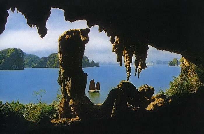
The coastal area and adjacent zones of the Bay are formed from thick layers of limestone and fragmented sediments, dating from ancient times to the present day. This is a picture deeply carving geological processes that occurred hundreds of millions of years ago. Throughout this time, while the colors, compositions, and architecture of the limestone layers were formed, fossil relics were preserved among the strata. These, along with the nature of the sediments, contribute to a scientific record of the region.
Many sedimentary rocks contain remnants and traces of ancient flora and fauna in various forms, including species that went extinct millions of years ago. This leaves a rich trove of information about the evolution and development of life on Earth.
In terms of geological structure, Ha Long Bay lies within the Coastal Zone of the Caledonia-Katasia structure, which was influenced by volcanic movements in the early Paleozoic era. Upon the Caledonide folded basement, Indosinian tectonics in the late Triassic (Trias) created block faults and sedimentary layers containing coal (anthracite) that were deposited. Vietnam’s famous latitudinal deep fault system developed in this region. This chain of movements also created the Cửa Lục and Hạ Long depressions, which were subsequently submerged. Traces of past and recent tectonic movements are clearly demonstrated in the Ha Long Bay area through strong deformations of sedimentary layers such as gentle and overturned folds, normal and reverse faults with tectonic breccia belts. These are living sculptures of nature preserved on limestone cliffs.
Ha Long Bay has a long geological history with various paleogeographic environments beginning nearly 570 million years ago. Between the Ordovician and Silurian (500 to 410 million years ago), the area was deep sea. Afterward, between the Carboniferous and Permian (340 to 250 million years ago), the area fell into a shallow marine environment. In the late Paleogene and early Neogene, from 26 to 20 million years ago, this marine area became part of a vast coastal plain. The area was inundated by seawater multiple times during the Quaternary period, over the past 2 million years. The present Ha Long Bay was formed about 7 or 8 thousand years ago due to marine transgression during the Holocene sedimentary evolution process that began around 17-18 thousand years ago
The geological history of Ha Long Bay includes three main mountain-building periods. The first is the formation of the Caledonide geosynclinal orogeny in the late Silurian, about 410 million years ago. The second is the formation of the Indosinide basement in the late Triassic, about 200 million years ago. The final Alpide orogeny in the late Paleogene, about 30 million years ago, created the distinction of horsts and graben depressions, which served as the basis for the later formation of Ha Long Bay. Two prominent paleogeographic environments existed in the Ha Long Bay area. The Carboniferous period, from 340 to 285 million years ago, was a warm period across the planet when giant swamps created large coal basins in Europe and America. In Ha Long Bay, carbonate sediments were deposited in shallow seas under hot and dry conditions, gradually forming thick limestone layers. Over hundreds of years, the seafloor gradually subsided, causing limestone in the shallow sea to accumulate into thick layers, ultimately reaching a thickness of 1,200m, creating conditions for the formation of the characteristic limestone karst landscape. Conversely, during the Triassic period 240 to 195 million years ago, when most of the world experienced hot and dry climatic conditions, the Ha Long region had a hot and humid climate. Decayed remnants of giant fern forests served as the basis for the coal deposits in the region.
2. Geological and Quaternary Values
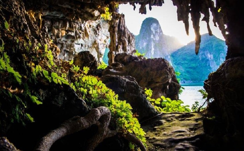
The Ha Long Bay area bears many precious characteristics of the Quaternary period. Quaternary sedimentary layers and the seafloor with flat surfaces help preserve ancient rivers, cave systems, and sediment deposition. Traces of ancient marine activities forming characteristic notches are important evidence of geological events and processes taking place during the time humans inhabited the earth. Especially from the Holocene epoch, about 11,000 years ago when modern, intelligent humans developed, Ha Long Bay holds numerous archaeological evidences connecting sea level changes with the development of ancient cultures such as the Soi Nụ culture and Ha Long culture. Unfortunately, this aspect has not yet been thoroughly researched or evaluated. In terms of marine geology, Ha Long is recorded as a modern sedimentary basin, a bay created by a barrier island system. The bay features strong tidal currents but weak waves. In an alkaline environment, the chemical erosion of calcium carbonate takes place rapidly, creating wide, bizarrely shaped marine notches. This appears to be an active process related to CO2 supplied from the respiration of algae and living plants in Ha Long Bay
3. Karst Geomorphological Values
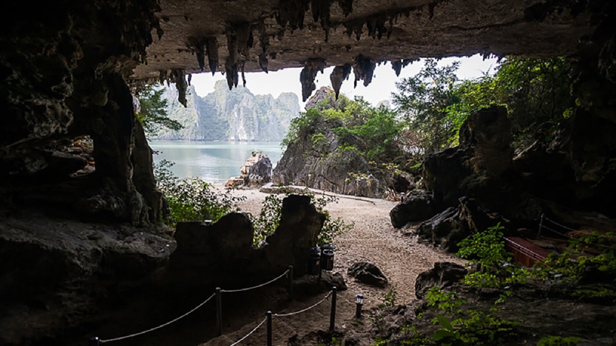
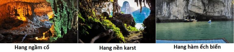
In Ha Long Bay, the main accessible caves are ancient passageways existing from the time karst was developing, although it exhibits various stages of fengcong and fenglin. Three main types of caves can be recognized in the limestone islands
1- Relics of ancient underground caves
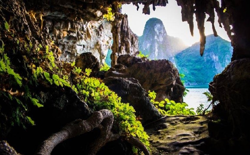
2- Ancient karst foot caves
3- Notch caves (marine notches)
The first group of caves, relics of ancient underground caves, includes Sung Sot, Tam Cung, Lau Dai, Thien Cung, Dau Go, Hoang Long, and Thien Long. Today, these caves lie at various elevations. Sung Sot Cave is located on Bo Hon Island. From truncated entrance chambers on high cliff headlands, a high and wide passageway exceeding 10m descends southward. Tam Cung is a large fissure cave developing on the bedding plane of limestone dividing the fissured chamber into three compartments. Thien Cung and Dau Go are relics of the same old cave system. Both lie on the northern side of Dau Go Island at elevations from 20 to 50m above sea level. Thien Cung features a large chamber exceeding 100m in length, blocked at both ends and nearly partitioned into smaller chambers by gigantic stalactite and stalagmite walls. Meanwhile, Dau Go Cave features a single large tunnel descending along a series of major fissures leading to a massive blockage.
The second group of caves consists of ancient karst foot caves, including caves like Trinh Nu, Bo Nau, and Tien Ong. Foot caves are a common feature of karst landscapes that have reached the stage of extensive lateral planation at base level. They can expand back into Me Cung Cave style stream caves flowing out from larger cave systems within the limestone. They are distinguished by primary passage elements close to horizontal planes and are often associated with eroded or accumulated terraces on old platforms. Trinh Nu Cave is among the larger foot caves in Ha Long Bay with a ceiling height of about 12m above sea level and a length of about 80m, developed through multiple stages. Bo Nau Cave is a horizontal cave containing old stalagmitic sediments, intersecting a floor plane inclined at 25º
The third group is notch caves, which are special features of Ha Long Bay karst. Seawater dissolution acting upon limestone and erosion from wave action form notches at cliff bases. Under favorable conditions, limestone dissolution allows cliffs to be progressively undercut and expanded into caves. A prominent characteristic of notch caves is a completely flat and horizontal ceiling cutting across the limestone strata. Some notch caves were not formed at present sea levels but at ancient sea levels associated with water level changes during Holocene transgression, even reaching Pleistocene water levels. Some have preserved the development of karst foot caves in terrestrial environments or preserved relics of ancient underground caves. One of Ha Long Bay’s most unusual features is the Ba Ham Lake group comprising hidden lakes and connecting tunnels—notch caves on Dau Be Island. From the island’s cliff emerges a notch cave 10m above water level, winding almost pitch-black, extending about 150m to Lake 1. Luon Cave lies on Bo Hon Island, extending 50m to a closed tidal lake. It features a gigantic stalactite dropping 2m and truncated at modern tidal water levels. It has undergone multiple formation stages
The karst landscape of Ha Long Bay holds international significance and foundational importance for geomorphological science. Fenglin karst, the type present across most of Ha Long Bay, is the harshest form of limestone landscape development. Broadly comparing these karst landscapes in height, slope, and limestone mountain count, Ha Long Bay likely ranks second worldwide only behind Yangshuo, China. However, Ha Long Bay has also undergone marine transgression, making the geomorphology of limestone terrain and mainland at least partly a consequence of marine erosion. Marine transgression has differentiated Ha Long Bay and made it unique globally. Other submerged limestone mountain areas exist, but none are as vast as Ha Long Bay
4. Mineral Resources and Other Values
One cannot overlook the value of Ha Long Bay’s mineral resources, although their extraction is a separate issue to be considered in relation to conservation and development. The Ha Long area possesses gigantic limestone reserves reaching hundreds of millions of tons with calcium carbonate contents from 96% to 100%. Conservation of this area must also account for preserving this massive carbonate mass. Limestone formation also features solid black silica layers, crucial for artistic materials. The Hon Gai coal mines are high-quality anthracite coal with calorific values from 7000 to 8400 Kcal/kg, ash content from 1.2% to 1.5%, and sulfur content from 0.2% to 1.2%
Destinations Where Visitors Can Experience Ha Long Bay’s Geological and Geomorphological Values
| Routes | Price | Sightseeing Stops |
|---|---|---|
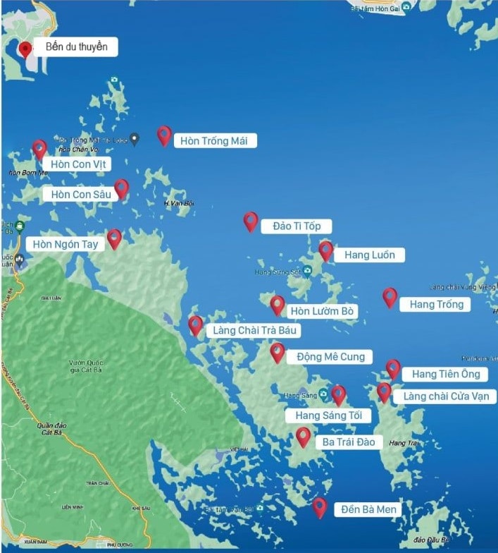
| VHL1 | 310,000 VND/person | Thien Cung Cave – Dau Go Cave – Cho Da Islet – Ba Hang Cave – Dinh Huong Islet – Trong Mai Islet (Fighting Cocks) |
| VHL2 | 310,000 VND/person | Soi Sim beach – Titov island – Sung Sot cave – Tung Sau lagoon – Me Cung cave – Bo Nau cave – Luon cave – Trong cave – Trinh Nu cave – Dong Tien lake |
| VHL3 | 260,000 VND/person | Cua Vang Floating Cultural Center – Tien Ong cave – Ba Ham lake – Ba Men temple – Ang Du – Bamboo forest |
| VHL4 | 260,000 VND/person | Co cave (Thien Canh Son) – Thay cave – Cap La cave – Vong Vieng – Tung Ang ecological area – Cong Do island – Hon Xep park |
| VHL5 | 310,000 VND/person | Thien Cung cave – Dau Go cave – Cho Da islet – Ba Hang – Dinh Huong islet – Trong Mai islet – Gia Luan pier (Cat Ba – Hai Phong) |
| VHL6 | 150,000 VND/person/trip | Chan Voi islet – Ba Cua lagoon – Tung Lam island – Cap Bai islet (final point bordering Gia Luan, Lan Ha bay – Hai Phong) |
| VHL7 | 600,000 VND/person | Visiting Ha Long Bay following VHL1-2-3-4 itineraries (applicable only to exploratory cruises) |
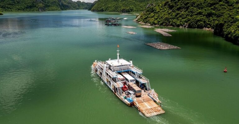
| VHL8 | 70,000 VND/person/trip | Tuan Chau International Passenger Port – Ha Long International Passenger Port – Nam Cau Trang port |
Above is all information about the geological and geomorphological values of Ha Long Bay, hoping the article brings useful information for you. If you have a demand to charter a boat to Ha Long Bay to visit, experience, and explore the values of Ha Long Bay, please contact us for more details