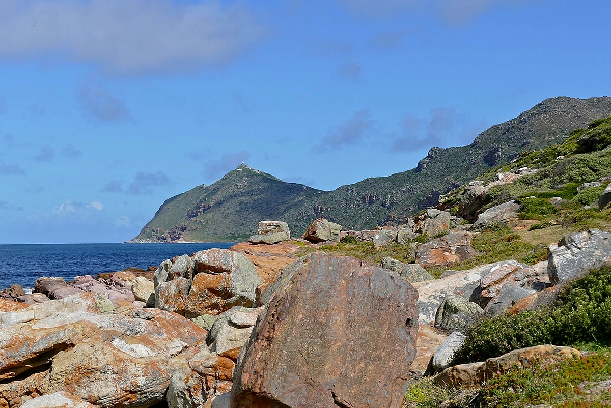
The Cape of Good Hope, a rugged rocky headland at the southern tip of the Cape Peninsula in South Africa’s Western Cape Province, stands as one of the greatest milestone landmarks in global maritime and geopolitical history. Forged by complex geological movements millions of years ago, this promontory juts boldly into the Atlantic Ocean where frigid Antarctic currents meet warmer waters from the Indian Ocean, creating a turbulent, treacherous stretch of sea vital to international maritime trade routes. Its terrain consists primarily of ancient Table Mountain sandstone strata eroded over millennia into sheer sea cliffs standing defiant against rolling ocean swells. Geographically, although often mistaken for the southernmost tip of the African continent—a title actually held by Cape Agulhas roughly 150 kilometers to the southeast—the Cape of Good Hope held decisive significance in the minds and nautical charts of explorers from the 15th century onward.
The historical trajectory of the Cape of Good Hope is inextricably linked to the European Age of Discovery—specifically the Portuguese crown under King John II—as Portugal sought a direct sea route to India to control the lucrative spice trade without relying on overland routes dominated by the Ottoman Empire. In 1488, explorer Bartolomeu Dias led a fleet past these storm-tossed waters, initially christening the headland the “Cape of Storms” (Cabo das Tormentas) in reflection of the harsh, perilous weather his crew endured. Recognizing its strategic promise for opening a direct sea corridor between Europe and Asia, however, the Portuguese king later renamed it the Cape of Good Hope, symbolizing optimism for reaching the East. This breakthrough paved the way for Vasco da Gama’s historic 1497 voyage rounding the cape to reach Calicut, India—forever reshaping global trade and breaking Middle Eastern commercial monopolies.
Shifts in global maritime supremacy over subsequent centuries brought corresponding changes in control over this strategic outpost. In the 17th century, the Dutch East India Company (VOC) recognized the Cape of Good Hope as an ideal replenishment station for vessels voyaging between Europe and Batavia. In 1652, Jan van Riebeeck established a permanent settlement at Table Bay—the precursor to modern-day Cape Town—marking the beginning of European colonization in southern Africa. The presence of the Dutch, followed by the British in the late 18th and early 19th centuries, transformed the Cape of Good Hope from a navigational waypoint into a major military stronghold and administrative hub. Territorial struggles between British colonial forces and local South African Boers also centered on controlling vital arteries passing through this region, shaping the complex social and political fabric of the Rainbow Nation throughout the early modern and modern eras.
Beyond its commercial and military significance, the Cape of Good Hope holds profound cultural resonance in the human imagination through the legend of the ghost ship The Flying Dutchman. According to maritime lore, a Dutch sea captain attempted to round the headland amid a ferocious gale, swearing he would succeed even if it took until Doomsday—bringing down a curse that condemned ship and crew to sail these waters eternally without ever making port. This enduring motif inspired countless works of Western literature, drama, and music, turning the Cape of Good Hope into an emblem of resilience and human courage in the face of untamed nature and uncharted perils. The interplay between dramatic historical reality and seafaring myth has deposited a rich cultural patina across every cliff face and crashing wave here.
In the contemporary era, the Cape of Good Hope remains one of South Africa’s most vital nature reserves and national heritage treasures, encompassed within Table Mountain National Park. It safeguards the extraordinarily diverse and unique Fynbos biome—part of the Cape Floral Kingdom, the smallest yet most floristically dense of the world’s six floral kingdoms. The headland’s maritime legacy is preserved through the historic lighthouse perched high atop Cape Point, offering sweeping panoramas across the vast ocean and reminding future generations of an age when small wooden sailing ships braved the world’s fiercest seas. Its iconic stature thus transcends a mere geographical coordinate, standing as an enduring testament to human exploration and a cornerstone in the story of globalization.
Located at the southwesternmost tip of the African continent within the Cape of Good Hope section of Table Mountain National Park, this distinctive landmass was shaped by orogenic tectonics and crustal shifts occurring hundreds of millions of years ago. Geologically, its bedrock consists primarily of sedimentary sandstones of the Cape Supergroup dating from the Ordovician to the Carboniferous periods. Over tens of millennia of relentless erosion by South Atlantic and Indian Ocean winds, these sandstone strata were sculpted into towering vertical cliffs forming a formidable natural barrier aligned north-to-south along the peninsula. The convergence of two ocean masses with differing temperatures and salinities generates a highly specialized microclimate that directly governs the distribution of endemic fynbos flora as well as architectural and spatial planning strategies implemented across the reserve over the centuries.
Master spatial planning at the Cape of Good Hope adheres strictly to ecological and landscape preservation principles, as the area forms a core zone of the UNESCO-listed Cape Floral Region Protected Areas. Unlike conventional coastal towns, its layout avoids large-scale civic complexes or dense urban footprints. Instead, space is organized into specialized functional zones: strict ecological conservation areas, access roads and parking nodes serving scientific research and tourism, and essential infrastructure such as the historic lighthouse and meteorological stations. Establishing these boundaries minimizes human impact on a fragile ecosystem where wildlife—including chacma baboons, ostriches, and bontebok antelope—roam freely.
Spatial zoning at the Cape of Good Hope respects natural topography, harnessing dramatic elevation changes between sea level and lofty rocky promontories to tier scenic viewpoints. The main paved road traversing the peninsula is kept intentionally narrow to protect wildlife corridors while channeling vehicles toward strategic hubs such as the Cape Point parking area and the base of the Cape of Good Hope headland itself. From these nodes, elevated timber boardwalks and open-mesh steel walkways allow visitors to reach lookout points without disturbing delicate topsoil or the shallow root networks of fynbos plants. Such engineering solutions exemplify sustainable planning, mitigating rainwater erosion and heavy foot traffic during peak travel seasons.
Built structures across the Cape of Good Hope and neighboring Cape Point reflect a minimalist, load-bearing design ethos engineered to withstand extreme marine weather. The foremost architectural landmark is the historic 19th-century lighthouse erected atop Cape Point at an elevation of 240 meters above sea level; because dense sea fog frequently obscured its beam from passing ships, it was replaced in 1919 by a lower, more effective lighthouse closer to the water. Observation stations, visitor centers, and the Flying Dutchman Funicular terminal utilize durable materials—galvanized steel, salt-resistant reinforced concrete, and local sandstone—allowing structures to blend seamlessly into the gray-brown cliffs and deep blue ocean backdrop.
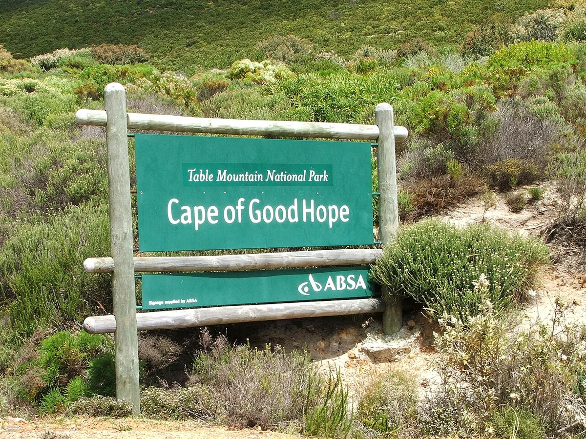
The surrounding landscape presents a dramatic contrast between sheer sedimentary cliffs and ribbons of fine white sand tucked into secluded coves like Dias Beach. Landscape planning avoids artificial ornamentation, focusing instead on highlighting the raw, untamed grandeur of this geographical frontier. Fynbos vegetation—characterized by proteas, ericas, and restios—forms a living natural carpet whose hues shift with the seasons and ocean humidity. Planners have installed timber signage and low-impact wooden barriers to guide pedestrian movement and prevent trampling of rare, endangered plant species.
Visitor and research utilities are similarly designed on a decentralized, eco-conscious model, deploying solar panels and small wind turbines to power lookout posts and ranger stations without stringing overhead power lines across rugged terrain. Restrooms and visitor facilities are concentrated at primary transit nodes and equipped with closed-loop wastewater treatment systems to safeguard groundwater and prevent coastal marine pollution. This approach underscores the steadfast commitment of South African heritage stewards to maintaining the ecological and historical integrity of one of the world’s premier maritime and biodiversity landmarks.
In short, architecture and spatial planning at the Cape of Good Hope exemplify a harmonious balance between public access and rigorous preservation of primordial geological and biological values. By tightly controlling building footprints, employing durable materials, and designing low-impact walkways, the reserve preserves its wild essence. Every deliberate planning choice protects this windswept headland, ensuring the Cape of Good Hope endures as a benchmark of sustainable landscape stewardship amid climate change and global tourism pressures.
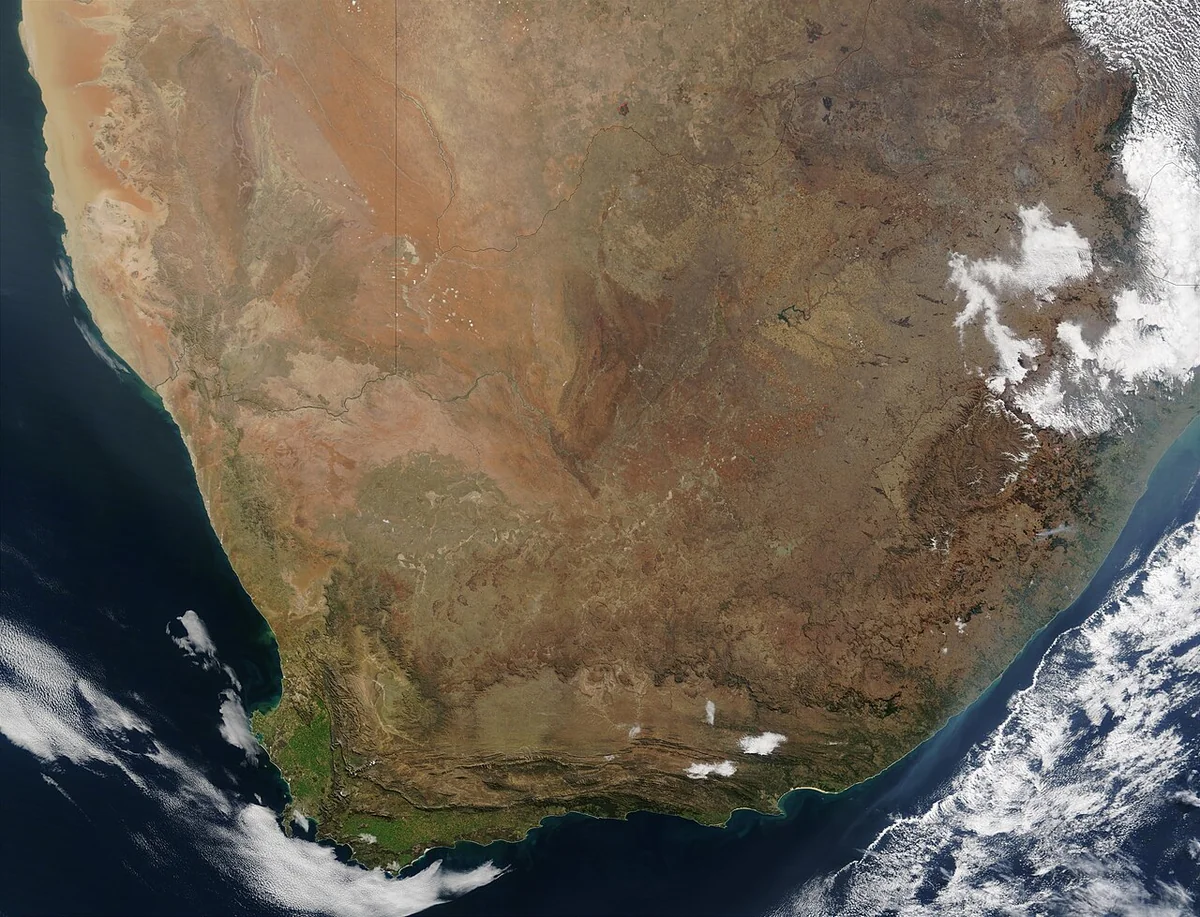
Positioned at the southwestern corner of the African continent, the Cape of Good Hope stands out in human chronicles not only through the lens of epic sea voyages, but also through a distinctive architectural and cultural legacy shaped by harsh geography. Morphologically, its landscape is the product of hundreds of millions of years of geological evolution, forming resilient beds of shale and sandstone belonging to the Table Mountain Group. In sharp contrast to the cosmopolitan architecture of nearby Cape Town, human-built structures at the Cape of Good Hope are austere, pragmatic, and wholly governed by natural forces. Built in the 19th century atop Cape Point, the historic lighthouse represents the dawn of industrial-era engineering along these tempestuous waters, where material selection and construction methods demanded careful calculation to endure ferocious gales where the Southern and Indian Oceans converge.
The primary building material used in historic structures here is local sandstone, paired with load-bearing fired brick and reinforced concrete in later restorations. Sandstone—prized for its high compressive strength and exceptional resistance to constant salt spray—provided an unyielding foundation for lookout posts, retaining walls, and weather stations. Early builders quarried exposed rock directly from the peninsula, hand-dressing massive rectangular blocks to fit tightly together with minimal mortar. This dry-stone masonry technique blended indigenous building traditions with Dutch and British maritime engineering experience. The interplay between muted gray sandstone and deep ocean blue yields a disciplined architectural palette reflecting human resolve in the face of untamed nature.
Structural engineering and spatial layouts at the Cape of Good Hope strictly follow aerodynamic principles to minimize wind resistance. Functional structures—from old watchposts to lighthouse keepers’ quarters—feature low-slung profiles with moderately pitched or vaulted roofs that allow gale-force winds to sweep smoothly overhead without generating destructive uplift. Exterior walls were built to extraordinary thickness—sometimes up to half a meter—to insulate interiors against wide day-night temperature swings and dampen vibrations from thunderous ocean swells slamming against the cliffs below. Compact windows framed in heavy teak or powder-coated cast iron and fitted with thick tempered glass seal out corrosive sea spray at all times. Every structural detail embodies survival-focused design, where beauty resides not in ornate decoration, but in functional endurance.
The aesthetic philosophy governing the built environment here rests on humility before the supreme power of the natural world. Unlike monumental edifices built to dominate the skyline, structures at the Cape of Good Hope nestle into rugged topography—tucked beneath sheer rock faces or perched quietly upon windswept ridges. Generations of architects and engineers recognized that heavy-handed intrusion into the fragile Fynbos ecosystem or geological formations would invite swift retribution from the elements. Consequently, the aesthetic here is one of quiet symbiosis, where human structures appear almost like natural outcrops weathered by time and sea wind. Architectural minimalism elevates the vast surrounding seascape and endless horizon as the dominant visual experience.
Artistically and symbolically, the Cape of Good Hope carries deep philosophical resonance surrounding thresholds, transition, and human destiny. In Western intellectual history, its renaming from the Cape of Storms to the Cape of Good Hope became etched into global consciousness as an enduring metaphor for hope triumphing over adversity. Its historic structures—especially the original mist-shrouded lighthouse retired because clouds so often veiled its beacon—stand as tangible witnesses to both human vulnerability and perseverance in confronting the unknown. Built forms here thus carry strong historical narrative weight, recording intersecting chapters of Portuguese, Dutch, British, and modern South African heritage.

Beyond masonry landmarks, the cultural depth of the Cape of Good Hope shines through landscape stewardship and reverence for indigenous ecosystems. Comprising thousands of endemic plant species, the Fynbos biome creates a living tapestry of high aesthetic value whose hues shift across the seasons—from crimson Protea blooms to silvery-green drought-adapted shrubs. Preserving elevated timber boardwalks throughout visitor zones exemplifies modern ecological awareness toward this natural heritage. Carefully routed trails protect topsoil and native root systems from heavy footfall while offering travelers a serene, contemplative encounter with the landscape.
This fusion of pragmatic engineering and rich maritime culture elevates the Cape of Good Hope into an extraordinary field site on the global cultural map. Every dressed sandstone block, meteorological station, and coordinate marker tells a story of human adaptation at the edge of the world. Viewed through architectural and cultural lenses, this destination transcends ordinary sightseeing to stand as a lasting monument to resilience, harmony between human craft and natural order, and some of the most stirring chapters in seafaring history.
Situated at the southwestern tip of Africa within the Cape Peninsula reserve, the Cape of Good Hope is a rugged sandstone promontory thrusting into the Atlantic Ocean. World maritime history marks it as the strategic milestone first rounded by Portuguese navigator Bartolomeu Dias in 1488—initially named the Cape of Storms before King John II renamed it the Cape of Good Hope to signify optimism for a sea trade route linking Europe with the Indian Ocean. Over the centuries, this once-dreaded graveyard of medieval merchant ships has evolved into one of the world’s premier destinations for geographic, ecological, and maritime exploration. Experiencing its interconnected zones comprehensively rewards a structured itinerary starting in central Cape Town and tracing the scenic Atlantic Seaboard through historic fishing villages before entering the national park.
An ideal opening stop on this journey lies along the False Bay shoreline in Simon’s Town, home to famous Boulders Beach and its thriving colony of African penguins (also known as jackass penguins). Beyond serving as an important ecological sanctuary, this zone showcases remarkable biological adaptation since two breeding pairs migrated here from Dyer Island in 1982. Visitors traverse sturdy elevated wooden boardwalks designed to safeguard fragile nesting burrows while observing penguin behavior up close without disturbing coastal habitats. The cove’s topography is sculpted by ancient, smooth granite boulders millions of years old that act as natural breakwaters, creating calm, shallow pools rich in plankton and small fish that sustain the colony.
Continuing southward along Cape Point Road brings travelers into the heart of Table Mountain National Park, where coastal scenery shifts dramatically from white sandy coves to towering wind-and-wave-sculpted sea cliffs. This central zone showcases lush Fynbos vegetation—one of Earth’s six floral kingdoms, boasting thousands of endemic species found solely along South Africa’s narrow Western Cape coastal belt. Deeper inside the peninsula, wildlife sightings become frequent, including bontebok antelope, Cape mountain zebra, chacma baboons, and diverse reptiles and seabirds inhabiting windswept slopes. Strict park entry gates preserve ecological integrity while reminding visitors to follow safety guidelines amidst wild habitats and rapidly shifting coastal weather.
The next major architectural and historical highlight is the historic Cape Point Lighthouse, perched more than 200 meters above sea level atop a precipitous sandstone crag. Built in the late 19th century, this beacon served as a critical navigational landmark for merchant fleets braving stormy seas until a newer lighthouse was built lower down in 1919 after dense fog repeatedly obscured the upper beam. Reaching the summit involves climbing steep stone steps or riding the Flying Dutchman Funicular—named after the legendary ghost ship of maritime folklore. From the crest, panoramic views open across boundless ocean waters where the cold Benguela Current from Antarctica meets the warm Agulhas Current from the Indian Ocean, generating powerful rips and dynamic coastal weather.
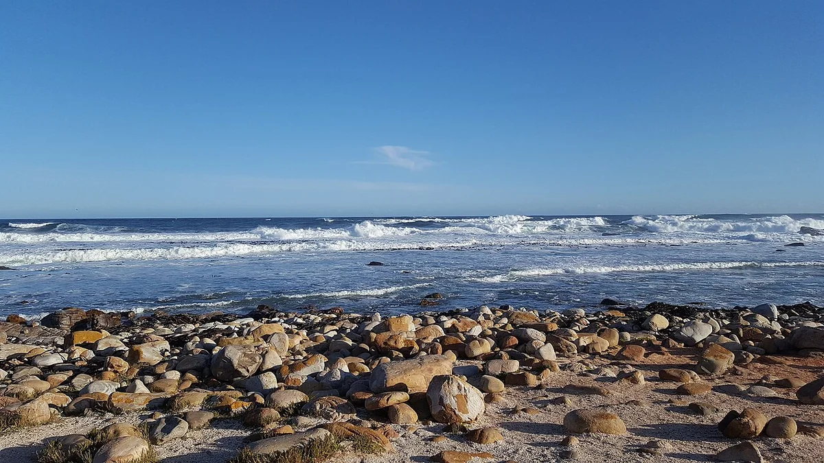
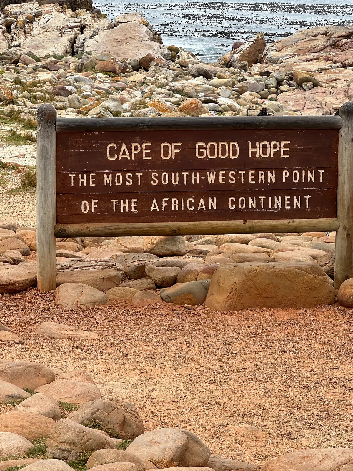
From Cape Point, the walking route branches southwest along a scenic coastal trail leading directly to the official Cape of Good Hope coordinate sign—one of the most photographed landmarks on Earth. Spanning roughly two kilometers over rugged, undulating hillside terrain, the trail rewards sturdy hiking footwear and good stamina to handle brisk southern ocean gusts. Along the path, sheer cliffs plunging into deep blue waters expose sedimentary rock strata hundreds of millions of years old, telling the geological story of ancient supercontinents drifting apart. Standing beside the official latitude-and-longitude marker of the Cape of Good Hope delivers a resonant sense of discovery, evoking the courage of early mariners who sailed into the unknown to connect distant continents.
Completing a thorough exploration of the peninsula’s southern tip leads to secluded coves tucked behind coastal ridges, such as Dias Beach and Buffels Bay, which preserve echoes of early voyages and offer rich marine viewing. Named after explorer Bartolomeu Dias, Dias Beach sits cradled between towering cliff walls and is accessible solely via a steep, lengthy wooden staircase hugging the mountainside. Rolling white-capped breakers crashing onto golden sand vividly illustrate the ocean’s relentless sculptural power. By contrast, Buffels Bay along the peninsula’s eastern shore offers calmer, warmer waters, natural tidal pools, and well-maintained picnic areas where visitors can spot migrating southern right and humpback whales from rocky headlands during whale season.
Taken together, exploring the interconnected zones of the Cape of Good Hope rewards thoughtful timing and route planning to maximize daylight and navigate the changeable southern Mediterranean climate. Pairing ecological stops like Boulders Beach with scenic hikes through Fynbos heathlands, the historic Cape Point Lighthouse, and the geographic marker at the continent’s southwestern edge creates a cohesive journey blending science, history, and natural wonder. Each zone serves not merely as a scenic vista, but as a living chapter in maritime history, tectonic geology, and conservation ecology—affirming the Cape of Good Hope’s timeless status as a symbol of human curiosity and exploration.
At this southwestern corner of Africa—where the icy Benguela Current meets the warm Agulhas Current—a distinctive ecosystem of visitor services, amenities, and local culture has evolved over time. Beyond serving as a historic geographic milestone tied to Bartolomeu Dias and Vasco da Gama, the surrounding region reflects a layered interplay of colonial heritage, indigenous settlement, and South Africa’s modern sustainable tourism planning. Rather than sprawling haphazardly, visitor facilities are carefully regulated to manage millions of annual international guests while strictly safeguarding the Cape of Good Hope section of Table Mountain National Park—balancing heritage access with the ecological integrity of the world-renowned Fynbos biome.
Service infrastructure centers around thoughtfully planned gateway hubs outside the reserve, notably Smitswinkel Bay and historic Simon’s Town along the peninsula’s eastern flank. Simon’s Town serves as the primary logistical and hospitality hub, offering accommodations, restaurants, medical facilities, and naval heritage museums for the southern Cape Peninsula. Its streetscape preserves 19th-century British colonial architecture alongside traditional Cape Dutch gables, creating an evocative coastal townscape. Lodging options span boutique hotels converted from historic naval storehouses to eco-lodges adhering to strict renewable energy and waste-management standards. Connecting road links from Cape Town are continuously maintained under national park oversight to minimize disruption to native chacma baboons and antelope habitats.
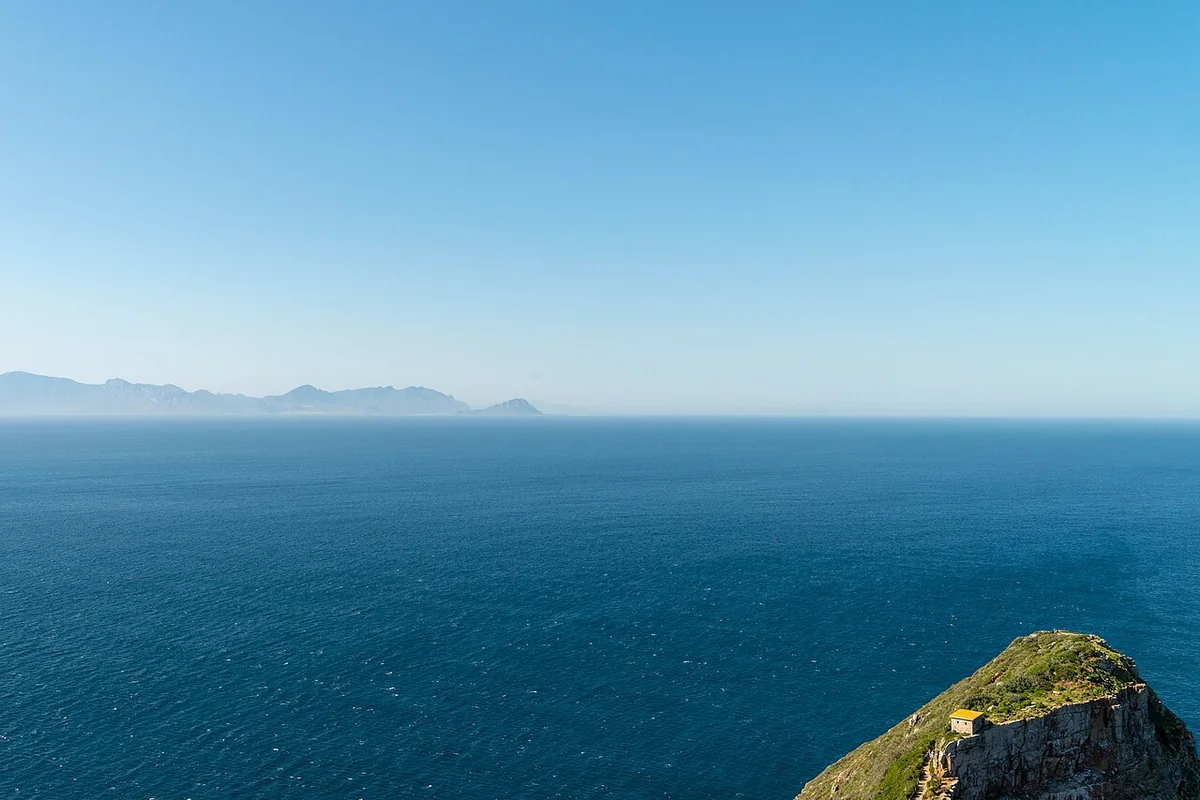
Local cuisine around the peninsula directly mirrors centuries of cultural exchange among indigenous Khoisan peoples, the Cape Malay community, and Dutch and British settlers. Waterfront restaurants in Simon’s Town and Scarborough serve fresh catches straight from cold Atlantic waters, including flame-grilled Cape cob, West Coast rock lobster, and traditional salted snoek stew. Aromatic Cape Malay culinary traditions—rich in turmeric, cinnamon, cloves, and chili—shine through local menus in dishes like spiced Bobotie and crisp lamb samosas, offering a delicious living lesson in the historic spice routes once sailed by the Dutch East India Company. Acclaimed South African wines from the nearby Constantia Valley—home to the Southern Hemisphere’s oldest wine-producing heritage dating back to 1685—pair effortlessly with breezy coastal dining.
Community spaces and local life across surrounding coastal towns reflect both historical strata and post-apartheid cultural vitality. Residents of Kalk Bay, Fish Hoek, and Simon’s Town include traditional line fishermen, artists, marine researchers, and hospitality professionals. Cultural exchange flourishes at local craft markets where artisans showcase wildlife-inspired woodcarvings, jewelry crafted from indigenous seeds, and handwoven textiles. Performances of Ghoema music—a vibrant genre blending rhythms brought by enslaved Southeast Asian communities with Dutch folk melodies—animate community gatherings and celebrate Cape Coloured cultural heritage, fostering sustainable local livelihoods while empowering residents to share their own historical narratives.
On-site visitor infrastructure is engineered to enrich engagement with nature without compromising pristine scenery. The scenic Simon’s Town railway line connecting central Cape Town to the peninsula’s gateway offers a nostalgic rail journey hugging the dramatic False Bay coastline. Marked long-distance walking routes such as the Hoerikwaggo Trail guide hikers through Fynbos habitats alongside knowledgeable park rangers. Interpretive centers at Cape Point feature detailed exhibits on famous shipwrecks—including the Lusitania and the SS Thomas T. Tucker—alongside interactive models of global ocean currents. These facilities operate under strict sustainability standards incorporating closed-loop water treatment, solar energy, and a park-wide ban on single-use plastics.
Everyday community life along the peninsula is also closely intertwined with marine conservation and scientific research. Oceanographic institutes and coastal monitoring stations continuously track sea-temperature shifts and their impact on African penguin colonies at Boulders Beach and Cape fur seals. Local residents actively volunteer with coastal cleanups, wildlife monitoring programs, and youth environmental education initiatives—creating a dynamic social fabric where traditional sustainable fishing coexists with modern ecological stewardship. Rather than a mere tourist stop, the Cape Peninsula functions as a living laboratory celebrating the enduring bond between humanity, maritime history, and the dramatic natural beauty of southern Africa.
Planning a field expedition to the Cape of Good Hope—the iconic southern headland of South Africa’s Cape Peninsula—requires a solid grasp of its shifting microclimates and strict national park regulations. Spanning more than 7,700 hectares within Table Mountain National Park, this destination is far more than a famous coordinate on maritime charts; it is an exceptionally sensitive endemic ecosystem. Choosing the optimal time of day and season is essential for a rewarding, comfortable visit.
Annually, the peninsula experiences a Mediterranean climate marked by dry summers from December to February and wet winters from June to August. The window from October through March offers the most favorable overall conditions for outdoor exploration, with pleasant daytime temperatures ranging from 20°C to 25°C and abundant sunshine delivering clear visibility across the meeting point of the Atlantic and Indian Oceans. However, summer also brings peak gusts of the “Cape Doctor”—a fierce southeasterly wind capable of exceeding 100 kilometers per hour that can make walking along exposed cliff ridges challenging. Conversely, while winter brings heavier rainfall and crisp Antarctic cold fronts, it rewards visitors with vibrant Fynbos wildflower blooms and crystal-clear air following passing storms.
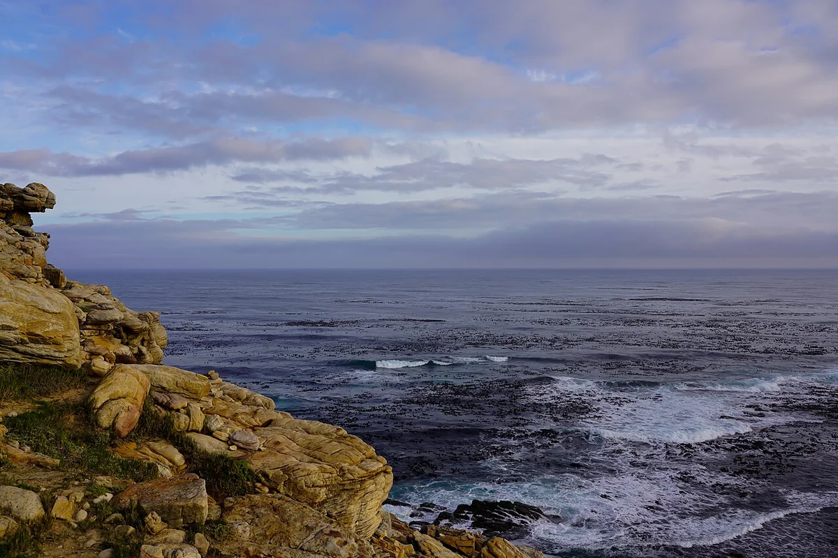
For a single-day itinerary, smart time management means arriving at the main reserve entrance gate right at opening—6:00 AM in summer or 7:00 AM in winter. The early window from 6:00 AM to 9:00 AM is the absolute golden hour: sea winds have not yet reached peak intensity, low morning light illuminates geological formations beautifully, and wildlife roams undisturbed before tour buses arrive. By midday, heavy traffic from Cape Town often creates bottlenecks at the Cape Point parking lot and the Cape of Good Hope signboard. Completing key viewpoints before 11:00 AM also shields travelers from intense ultraviolet radiation, as atmospheric ozone is relatively thin at this latitude and UV indexes frequently reach extreme levels between 11:00 AM and 3:00 PM.
The most practical and flexible way for independent travelers to reach the reserve is by rental car departing central Cape Town via the scenic Atlantic Seaboard route (M6) and iconic Chapman’s Peak Drive before heading south through Kommetjie, or via the M3 freeway connecting to the M65 coastal road. Driving takes roughly 90 minutes to two hours depending on your starting point and scenic photo stops. Having your own vehicle is essential for schedule flexibility, as public transit does not enter the interior of the nature reserve; while commercial bus tours depart daily, they offer limited freedom to linger at quieter spots like Dias Beach or coastal hiking trails.
Dressing for the Cape of Good Hope demands strict adherence to layering to handle abrupt weather shifts that can occur within an hour. Even on warm summer days, ocean winds carrying chill off the Benguela Current can feel brisk atop exposed rocky headlands. Pack a moisture-wicking base shirt, a warm mid-layer fleece, and a high-quality windproof, waterproof outer shell. Long hiking trousers made of quick-dry stretch fabric or canvas protect legs against thorny Fynbos scrub and insects, while broken-in hiking boots or trail shoes with strong grip are indispensable for climbing steep stone stairs to the lighthouse and traversing gravelly cliff paths.
Essential personal gear for this rugged coastal environment includes polarized UV-blocking sunglasses, a wide-brimmed hat with a secure chin strap to prevent it from blowing away in strong gales, broad-spectrum SPF 50+ sunscreen, and a large refillable water bottle. Commercial amenities inside the park are intentionally limited—concentrated mainly at the Two Oceans Restaurant complex at Cape Point and facilities at Buffels Bay—so carrying trail snacks and ample drinking water is vital for multi-hour walks.
National park laws and visitor etiquette are strictly enforced to protect ecological integrity and human safety. Feeding wildlife—especially the resident chacma baboons—is strictly prohibited and carries heavy fines or legal prosecution under South African law. Because baboons here have grown habituated to humans and can become assertive when seeking food, never carry visible snacks in hand, always keep car doors and windows locked when parked, and maintain a safe distance of at least ten meters. Picking or removing any Fynbos plants, shells, or rocks from the reserve is likewise illegal under environmental heritage protection statutes.
Overnight stays inside the Cape of Good Hope reserve are tightly restricted to registered researchers and guests booking self-catering SANParks eco-cottages at Buffels Bay or Olifantsbos. Littering, smoking in high fire-risk dry-season zones, and flying drones without special authorization from Table Mountain National Park authorities incur severe administrative penalties. Thoughtful field preparation, respect for biosecurity protocols, and attunement to the wild rhythms of this dramatic headland ensure a safe, deeply enriching, and unforgettable journey to the Cape of Good Hope.
To experience this journey seamlessly alongside a local guide, explore our curated Germany – Austria – Hungary – Czech Republic 9D8N tour with a thoughtfully planned itinerary.