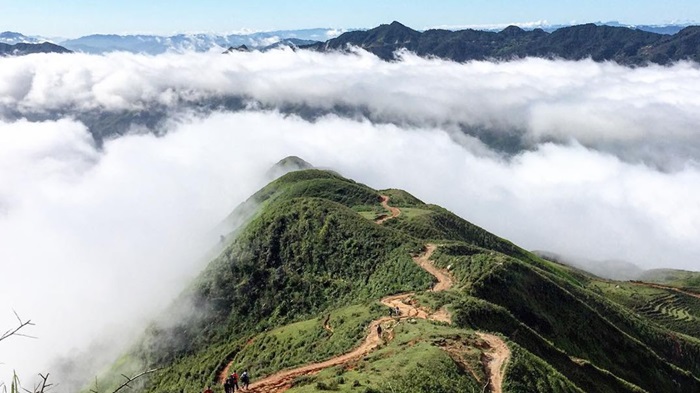
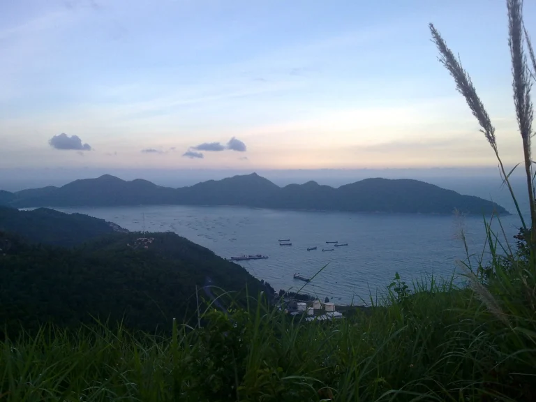
Located in Luc Hon commune, Cao Xiem Mountain is not a widely known tourist destination due to the rugged terrain of the peak considered the “roof” of the province. Standing at 1,429m above sea level, the towering peak is visible from any village in Binh Lieu. During harvest season, locals look up at Cao Xiem Mountain to predict incoming rain, helping them decide when to quickly harvest their rice and corn.
Cao Xiem Mountain is situated in Luc Hon commune, Binh Lieu district, Quang Ninh province. As the highest peak in the Northeast region of Quang Ninh, reaching 1,429 meters above sea level, it is celebrated as the “roof of Quang Ninh.” Viewed from afar, it stands majestically between the mountains and the sea, creating a grand and captivating landscape. The peak can be observed from villages across Huc Dong, Vo Ngai, Tinh Huc, Luc Hon, Dong Tam, and Hoanh Mo. Cao Xiem Mountain is a symbol of vitality and pride for the people of Binh Lieu, as well as a magnet for travelers who love exploring nature.
To explore the summit of Cao Xiem, you must hike approximately 7km, primarily along mountain trails featuring rocky terrain shrouded in clouds year-round and vast grassy hills. There are three ways to reach the summit. The first is from Cao Thang village, Luc Hon commune. The second is from Luc Ngu village, Huc Dong commune, and the third is from Ngan Meo village, Luc Hon commune. If you choose the first route, you will need to park your vehicle at a local resident’s house and hike for about 1 hour and 30 minutes to reach the top.
During our journey to the summit of Cao Xiem, we had the opportunity to encounter villages of the Dao and San Chi ethnic groups in Binh Lieu district, with their beautifully architectural houses. Following the trail through vast forests, we admired beautiful wildflowers and ate wild fruits for an energy boost. After crossing endless pine forests, steep slopes, and streams, a lush green meadow with incredibly fresh air appeared. On this grassland, we paused to enjoy the harmony with the mountains and forests, halfway through our conquest of the peak. Continuing our journey, we trekked through a 2km-long pine forest, navigating steep slopes and winding paths dotted with large boulders.
On foggy days, this section is the greatest challenge in conquering Cao Xiem. You will see clouds weaving together with every step. Due to the dense fog, where visibility is often less than 10m, it is essential to stay close to one another to avoid getting lost. On clear days, everything becomes easier. During the hike, you can stop at various stages to rest, admire the scenery, and enjoy the cool breeze and fresh air of the Northeast mountains. The journey was arduous, and we were overjoyed upon reaching the summit. Standing on the highest point of the Cao Xiem range, we could see a vast expanse of the region.
From the eastern side of the peak, one can see as far as Hai Ha and Dam Ha districts out to the Gulf of Tonkin. From the west, we could overlook the high mountain range along the Vietnam-China border. From the south, we could see the Binh Lieu valley and, further away, the low hills of Tien Yen district. From the north, we could see the majestic Cao Ly and Quang Nam Chau mountain ranges. On the summit of Cao Xiem, there are still trenches and paths carved through the mountain. In the past, a flag was planted here to assert Vietnam’s sovereignty. Therefore, the San Chi people call Cao Xiem Mountain “Keo Kam Khay” (Flag-planting Mountain), while the Tay people call it “Khau Cam Co.”
In 2017, Binh Lieu district built a triangular landmark on the summit of Cao Xiem Mountain. Standing on the peak, we also admired the natural stone walls stretching for kilometers, known as the “miniature Great Wall” of Binh Lieu.
According to locals, these stone walls were created by the people of Luc Hon and Huc Dong communes to divide territory and prevent livestock from wandering. Another story goes that, long ago, a young couple from Luc Hon and Huc Dong fell in love and would sneak up the mountain to meet. Their parents and villagers discovered them and forbade them from seeing each other. To prevent similar incidents, the people of the two communes built the stone fence. Leaving the summit, we witnessed the intersection of heaven and earth at the Northeast border of the Fatherland and wished for that land to remain forever pure and peaceful.
See more: Binh Lieu Tours