The Phi Phi Islands, comprising two main islands—Phi Phi Don and Phi Phi Leh—along with several smaller neighboring limestone islets belonging to Krabi province in southern Thailand, are a unique geological structure formed through hundreds of millions of years of marine sedimentation during the Permian period. Geomorphologically, the archipelago is essentially the summit of a submerged limestone mountain range that was submerged due to tectonic plate movements and global sea level fluctuations across geological epochs. Sheer towering cliffs, complex subterranean cave systems, and karst valleys eroded over long periods by wind and rainwater have created a rugged yet naturally aesthetic terrain. Maya Bay, nestled deep within Phi Phi Leh Island, is a classic karst sinkhole where the roof of a large cave completely collapsed in a past geological era, creating an arc-shaped basin surrounded by cliffs hundreds of meters high, opening only through a narrow passage toward the Andaman Sea.
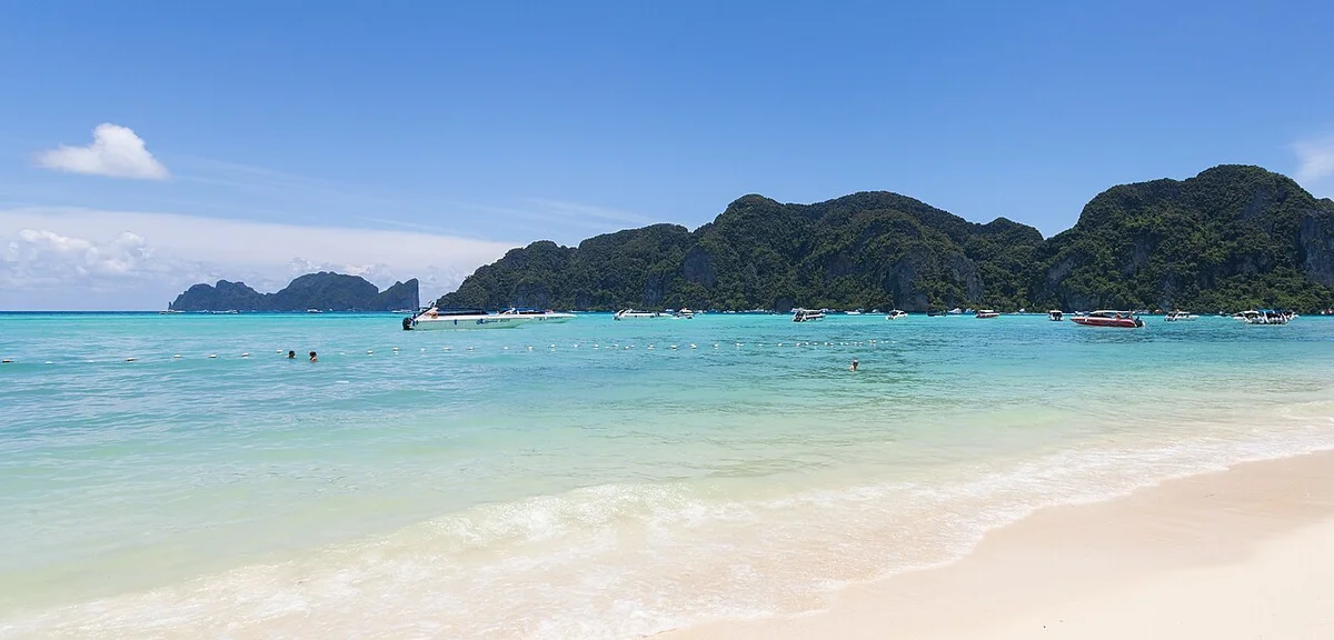
In ancient maritime historical records, the Phi Phi archipelago area was once an important stopover along maritime trade routes connecting the Indian Ocean with the South China Sea and the Gulf of Thailand. Malay fishermen and the Chao Leh, also known as the Moken sea nomads, were the first indigenous inhabitants to settle here centuries before the Kingdom of Siam established administrative control over the area. Their lives were tied to the rhythm of the tides, traditional fishing, and harvesting natural swiftlet nests in the treacherous caves of Phi Phi Leh Island. For centuries, the archipelago remained isolated from much of the urban development of mainland Thailand, serving as an ecological buffer zone and a safe haven for merchant fleets avoiding storm seasons thanks to its sheltered bays and effective natural wave-shielding topography.
The shift in the economic and geographical role of the Phi Phi Islands began strongly in the late twentieth century, when the mass tourism industry started reaching the pristine islands of southern Thailand. From a cluster of islands with only a few scattered fishing villages, Phi Phi Don quickly transformed into an accommodation service and tourist transit center thanks to its fine white sand beaches and rich fringing coral reef ecosystems. The event marking a global turning point for Maya Bay was the selection of this location by a Hollywood film crew as the main setting for the movie The Beach released in the year 2000. The film, starring actor Leonardo DiCaprio, portrayed Maya Bay as the last pristine paradise on Earth, thereby triggering an unprecedented wave of mass tourism pouring into an ecological space that was extremely fragile and sensitive.
However, the pressure from massive daily tourist numbers pushed the ecosystem here to the brink of severe ecological collapse in the early twenty-first century. The coral reefs beneath the clear waters of Maya Bay were heavily devastated by tourist boat anchors, sunscreen discharged into the water environment halted the photosynthesis process of corals, and untreated wastewater discharge pressure rapidly depleted endemic marine species. In response to this situation, in mid-2018, the Royal Thai Government made a landmark historical decision to completely close Maya Bay to all tourism activities. This decision faced short-term economic controversy from local tour operators, but received absolute consensus from the international scientific community as an urgent action to save a dying natural heritage.
The multi-year closure period driven by conservation policies combined with indirect impacts from the global pandemic witnessed a miraculous recovery of nature at Maya Bay. Marine scientists recorded the return of hundreds of blacktip reef sharks, an apex predator species that had been absent for decades, along with the vigorous regeneration of staghorn and brain coral colonies on the sea floor. The success of this ecological restoration project has turned the Phi Phi Islands and Maya Bay into a global symbol of sustainable tourism management and a valuable lesson on the conflicting relationship between economic growth based on the smokeless industry and the pristine preservation of natural biosphere values.
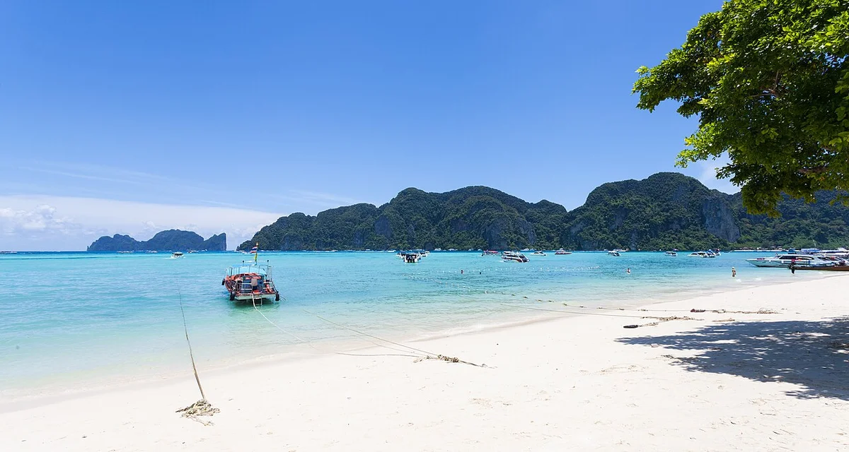
From a symbolic cultural perspective, the Phi Phi Islands today not only represent the characteristic landscape beauty of the Andaman Sea region but also reflect the adaptive capacity and resource governance mindset of Thailand tourism in the Anthropocene era. The subsequent reopening of Maya Bay was carried out under extremely strict legal frameworks, including a ban on boats docking directly onto the sandy beach, hourly visitor limits, and strict control of recreational diving activities. These regulations demonstrate a fundamental shift in strategic awareness, moving from maximizing resource exploitation to future-oriented conservation methods, ensuring that future generations still have the opportunity to admire one of Southeast Asia’s most unique geological and ecological wonders.
Comprehensively viewed from the perspective of historical research and human geography, the Phi Phi Islands and Maya Bay have undergone a volatile life cycle from the isolated wilderness of indigenous fishing communities, to the peak of global mass fame through the lens of cinema, and finally entering the mature stage of deep ecological conservation awareness. The symbolic status of this landmark has thus transcended the boundaries of a conventional leisure destination to become a textbook exemplary case study in world natural heritage management. The vestiges of millions of years of geological history combined with the painful lessons from contemporary tourism management have painted a sustainable portrait where the value of nature is placed first as the most accurate measure of modern tourism’s civilized development.
The Phi Phi Islands, a micro-tectonic geological feature belonging to Krabi province in southern Thailand, are a testament to the Earth’s crust movement over millions of years, where Permian limestone mountain ranges were eroded and isolated amidst the Andaman Sea. Morphologically, the archipelago consists of two main islands, Phi Phi Don and Phi Phi Le, along with several adjacent rocky islets such as Bida Nok and Bida Nai. The spatial tectonic process here is strongly governed by geological faults creating vertical limestone cliffs hundreds of meters high, enclosing sedimentary valleys and shallow lagoons. The great height differences between the sheer vertical limestone peaks and the flat alluvial strips at sea level have shaped a distinctly differentiated landscape structure, requiring urban planners and territorial management authorities to apply specific technical interventions to balance the demand for artificial spatial development and the preservation of fragile ecosystems.
On the largest island, Phi Phi Don, the master planning layout revolves around a narrow sandy isthmus connecting two large limestone mountain masses to the north and south. This isthmus has a width of only a few hundred meters, formed from the accumulation of marine sediments over centuries, creating a flat terrain extremely vulnerable to extreme weather events and climate change. Over the past decades, the spatial structure of this isthmus has undergone a dramatic transformation from a sparse fishing village into a dense coastal tourism urban area filled with accommodation, commercial, and logistical infrastructure. Zoning planning here has long faced the difficult problem of building density, when transient population pressure soaring during peak tourism seasons exceeds the ecological carrying capacity of available technical infrastructure, especially wastewater treatment systems and freshwater supply which depend entirely on limited island resources.
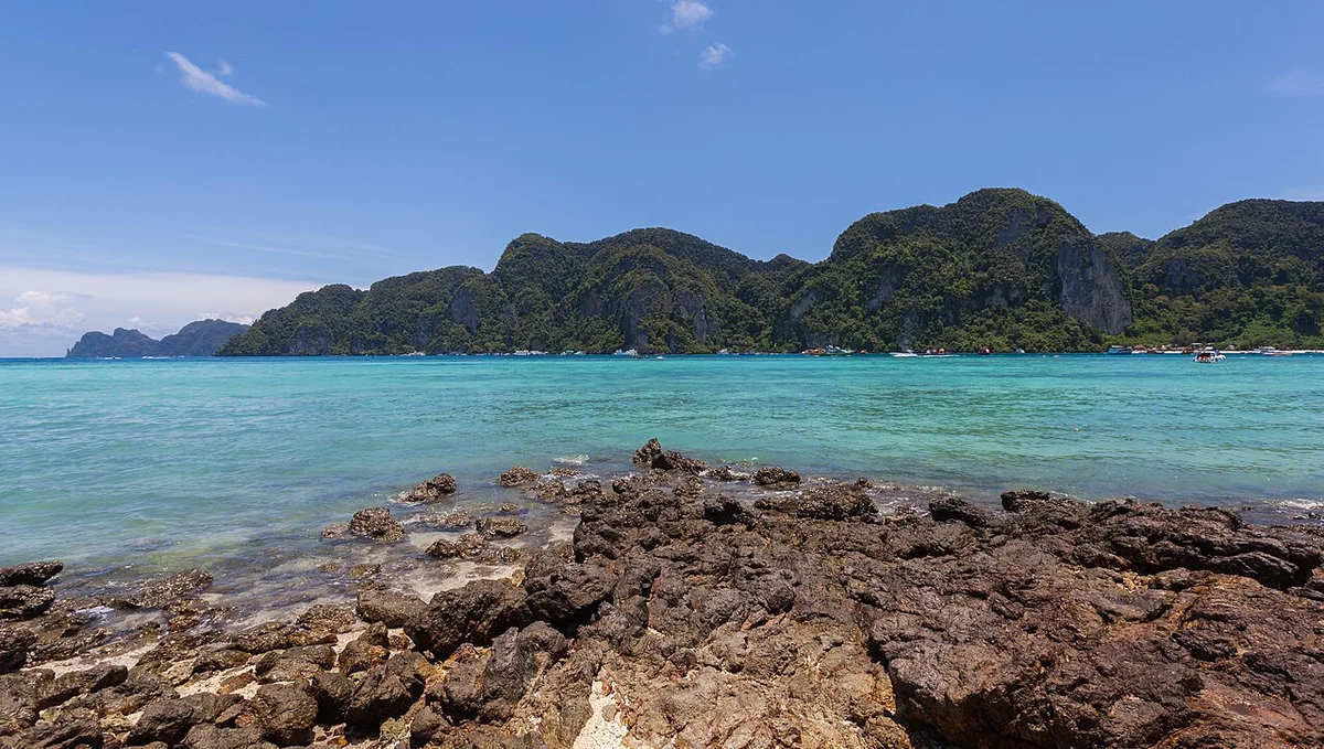
The spatial division solutions on Phi Phi Don clearly reflect the functional stratification horizontally and vertically across the central isthmus. The areas close to both bay shores, adjacent to shallow water ports and piers, are planned as main water transportation axes and passenger reception spaces, concentrating bustling commercial service activities. Moving deeper into the core of the isthmus is an intricate network of narrow pedestrian pathways, completely devoid of heavy motorized vehicles due to the narrow spatial characteristics of traffic. Architectural structures here mainly use reinforced concrete structures combined with lightweight materials, complying with height regulations to avoid disrupting the visual proportions with the surrounding limestone cliffs. However, spontaneous urbanization in the past has left serious landscape consequences, forcing urban managers to issue stricter legal frameworks to control coastal protection corridors and restore natural ventilation corridors passing through the isthmus.
In stark contrast to the vibrancy of Phi Phi Don, Phi Phi Le Island maintains an almost completely intact natural structure thanks to topological isolation and strict conservation measures by the Thai government. Phi Phi Le is a huge ring-shaped limestone mass flooded in the central part, creating unique karst coves and caves. Space here is not dominated by solid artificial architectural structures, but instead by a pure marine ecological landscape featuring fringing coral reefs, seagrass beds, and tropical rainforests on limestone mountains. Spatial planning on Phi Phi Le focuses entirely on controlling the movement routes of watercraft and visitor access through strictly designated docking points, in order to minimize mechanical pressure on the seabed ecosystem and coastal habitats.
Maya Bay, located deep inside Phi Phi Le Island, is a typical enclosed micro-ecosystem where geological tectonic processes have created a shallow water basin thoroughly shielded by towering limestone mountains on three sides. The entrance to the bay is a narrow marine cleft to the west, while the landside is a fine white sand beach nourished by gentle ocean currents and organic sediments from the surrounding vegetation. Spatial planning in Maya Bay in the past witnessed severe overloading when hundreds of tourist boats anchored directly on coral reefs, leading to the comprehensive degradation of the coral reef ecosystem and dune vegetation. Fundamental changes in national tourism space management strategy have forced this area to undergo long-term closures for natural ecological restoration.
Technical intervention and landscape architecture solutions at Maya Bay today demonstrate advanced ecological planning thinking, prioritizing the restoration of pristine spatial structures over commercial tourism infrastructure development. Absolutely no permanent accommodation or restaurants are allowed to be built on the sandy beach or inside the bay. Instead, a system of modular wooden piers and walkways has been established at the rear of the bay, in the Loh Samah area, directing visitor movement paths to walk through ecological steps to reach Maya Bay without trampling on the sand dune system and native vegetation. Passenger boats are not allowed to enter shallow waters inside the bay but must anchor at designated positioning buoys planned far away from coral reefs, thereby protecting the water surface space from the negative impacts of oil pollution and propeller waves.
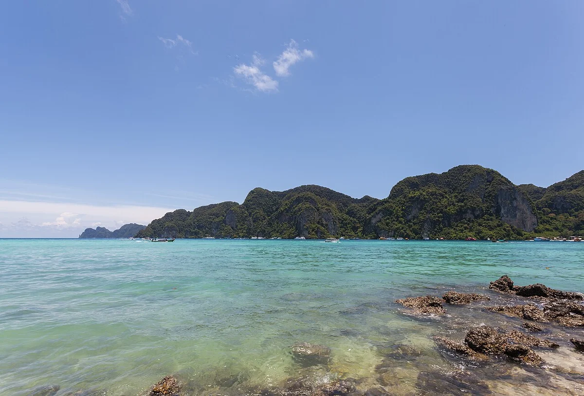
The landscape surrounding the Phi Phi Islands and Maya Bay is further shaped by tropical marine ecosystems with daily tidal variations. The difference in sea levels between spring tides and neap tides creates alternating currents through narrow straits between islands, acting as a natural biological pump system providing nutrients for plankton and corals. Modern landscape planners must carefully calculate these marine dynamic factors when designing coastal defense works, waterway traffic zoning buoy systems, and environmental monitoring stations. Detailed GIS mapping of seabed topography and currents has become a core tool in marine spatial management, helping to clearly demarcate no-take zones, controlled access zones, and ecological restoration zones.
Overall, spatial structure and architectural planning in the Phi Phi Islands and Maya Bay reflect a process of rethinking the relationship between artificial space and the natural environment. From past mistakes when mass tourism development severely damaged landscape morphology and ecological structure, managers have shifted toward planning models based on ecological carrying capacity and strict preservation of geological morphology. The combination of strictly controlling land construction density on Phi Phi Don and applying non-invasive technical solutions at Maya Bay has set a new standard in island tourism spatial management in Southeast Asia, ensuring that the unique geomorphological and ecological values of this archipelago can be sustainably maintained for future generations.
The Phi Phi Islands, comprising two main entities, Phi Phi Don and Phi Phi Leh, alongside adjacent limestone islands belonging to the Andaman Sea region of the Kingdom of Thailand, are a sedimentary geomorphic complex dating back hundreds of millions of years, where historical tectonic geology has created a unique spatial picture shaping the entire cultural structure and art of survival of the indigenous community. Unlike ancient cities or mainland civilization centers where humans impose volumetric will onto stone and wood, architectural and artistic space here is a process of extreme ecological adaptation, where fishing residents and Moken sea nomads have coexisted, interacted, and created deeply distinctive humanistic values. Regarding landscape morphology, Permian limestone domes rising vertically hundreds of meters form giant natural walls, enclosing internal lagoons like Maya Bay, where nature’s shelter has shaped a specialized microclimate and an extremely rich coral reef ecosystem. The indigenous aesthetic philosophy here does not originate from crude interference with the natural environment, but is based on the principle of maximum assimilation, absolute respect for the authority of karst terrain, where initial artificial structures were all temporary, nomadic, and completely harmonious with tidal rhythms as well as the Southwest monsoon cycle.
During historical development, construction techniques and materials in the Phi Phi Islands directly reflect human adaptive capacity against the harsh challenges of a tropical island environment. Due to topographic conditions severely divided by vertical cliffs and extremely limited flat land area, traditional building materials relied mainly on available resources from coastal ecosystems and mangrove forests. Cajeput wood, coconut wood, combined with palm leaves and sea thatch were used to build traditional stilt houses, a classic architectural design solution helping to adapt to high tide phenomena and protecting living spaces from the high humidity of sandy ground. Traditional wooden mortise and tenon techniques without metal nails were skillfully applied by generations of Thai craftsmen and local fishermen, allowing house structures to have certain flexibility against the power of tropical storms blowing from the Andaman Sea. When mass tourism erupted in the final decades of the twentieth century, building materials on Phi Phi Don witnessed a landmark transition with the appearance of reinforced concrete, fired bricks, and tempered glass to serve large-scale accommodation, restaurant, and service infrastructure systems. This transformation, while providing the capacity to serve large numbers of international tourists, also created unprecedented pressures on the carrying capacity of the fragile ecosystem, leading to profound academic debates on the balance between economic growth and landscape heritage preservation.
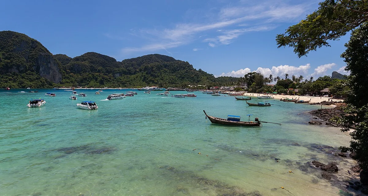
The cultural depth of Maya Bay and the Phi Phi Islands is also clearly revealed through the organization of community living spaces and the spiritual worldview of seafaring residents. Religious architectural spaces, although modest in scale compared to magnificent Buddhist temples in central or northern Thailand, still play a spiritual focal point where fishermen perform peace-seeking rituals before each long maritime voyage in rough seas. Decorative art on architectural structures here often bears strong imprints of Theravada Buddhist culture combined with indigenous beliefs about deities ruling the ocean, through sophisticated wood carving motifs of marine creatures, sea waves, and lotus flowers. The dominant color in traditional architecture is the natural shade of raw wood, the color of dry leaf roofs, and the golden color of Buddhist decorative details, creating a harmonious yet solemn contrast with the jade green color of sea water and the white color of fine sand strips. Cultural intersection between indigenous Muslim communities living in several nearby areas and the Thai Buddhist community also contributes to a diverse religious architectural picture, where small mosques with characteristic domes coexist peacefully with small shrines and altars beside cliff faces.
Maya Bay, as a landscape hazard zone of high symbolic value, represents a typical case of conflict and harmonization between mass cinematic art and architectural landscape ecological conservation. When the Hollywood movie titled The Beach was filmed here in 1999, the film crew carried out several temporary landscape interventions to recreate an ideal wild space according to the script, including test-planting additional alien plant species along the white sandy shore. These set-design artistic interventions, while creating a powerful global mass pop culture imprint, inadvertently triggered a severe ecological crisis as millions of tourists flocked here in the following two decades. The overload of visitors led to serious degradation of coastal coral reef ecosystems and native vegetation, forcing the royal Thai government to execute unprecedented administrative and technical intervention measures. Closing the bay for many years for natural recovery has become a historical milestone in heritage management thinking, where landscape art is redefined not as maximum visual exploitation, but as the right to recovery and absolute respect for natural ecological processes.
Viewed from the perspective of architectural anthropology and cultural history, the Phi Phi Islands and Maya Bay are not merely conventional resort destinations, but a complex spatial entity preserving deep symbolic meaning layers regarding the relationship between humans and wild nature. The volumetric language of vertical limestone cliffs, combined with artificial structures ranging from primitive to modern, tells the story of resilient human adaptation to a geographical environment full of uncertainty and perils from the sea. Lessons drawn from management, planning, and space conservation here are reshaping global ecotourism industry standards, where the true artistic value of a destination is measured by its capacity to preserve landscape originality and respect for Earth’s natural rhythm. Modern architectural studies approaching this area must acknowledge that no man-made construction can surpass the grandeur of millions-of-years-old limestone arches, and the highest task of spatial design art in the future is stepping back, making way for the comprehensive recovery of pristine island marine ecosystems.
The Phi Phi Islands, an archipelago belonging to the Andaman Sea located about forty kilometers southeast of the western coast of southern Thailand from Phuket, constitute a unique geological entity comprising six main islands with Permian limestone foundations heavily eroded over millions of years. This spatial complex revolves around two focal centers, Phi Phi Don and Phi Phi Leh, alongside adjacent islets such as Bida Nok, Bida Nai, and Mosquito Island. Specific geological tectonic activity has created a system of vertical cliffs hundreds of meters high, enclosing saltwater lagoons, underground cave systems, and fine white sand strips formed by wave erosion on coral reefs. The journey to approach this archipelago usually departs from major piers in Phuket or Krabi by speedboat or large passenger ferry, crossing shallow waters of the Malacca Strait to enter the marine ecological core zone strictly managed under the Hat Noppharat Thara – Mu Ko Phi Phi National Park administration.
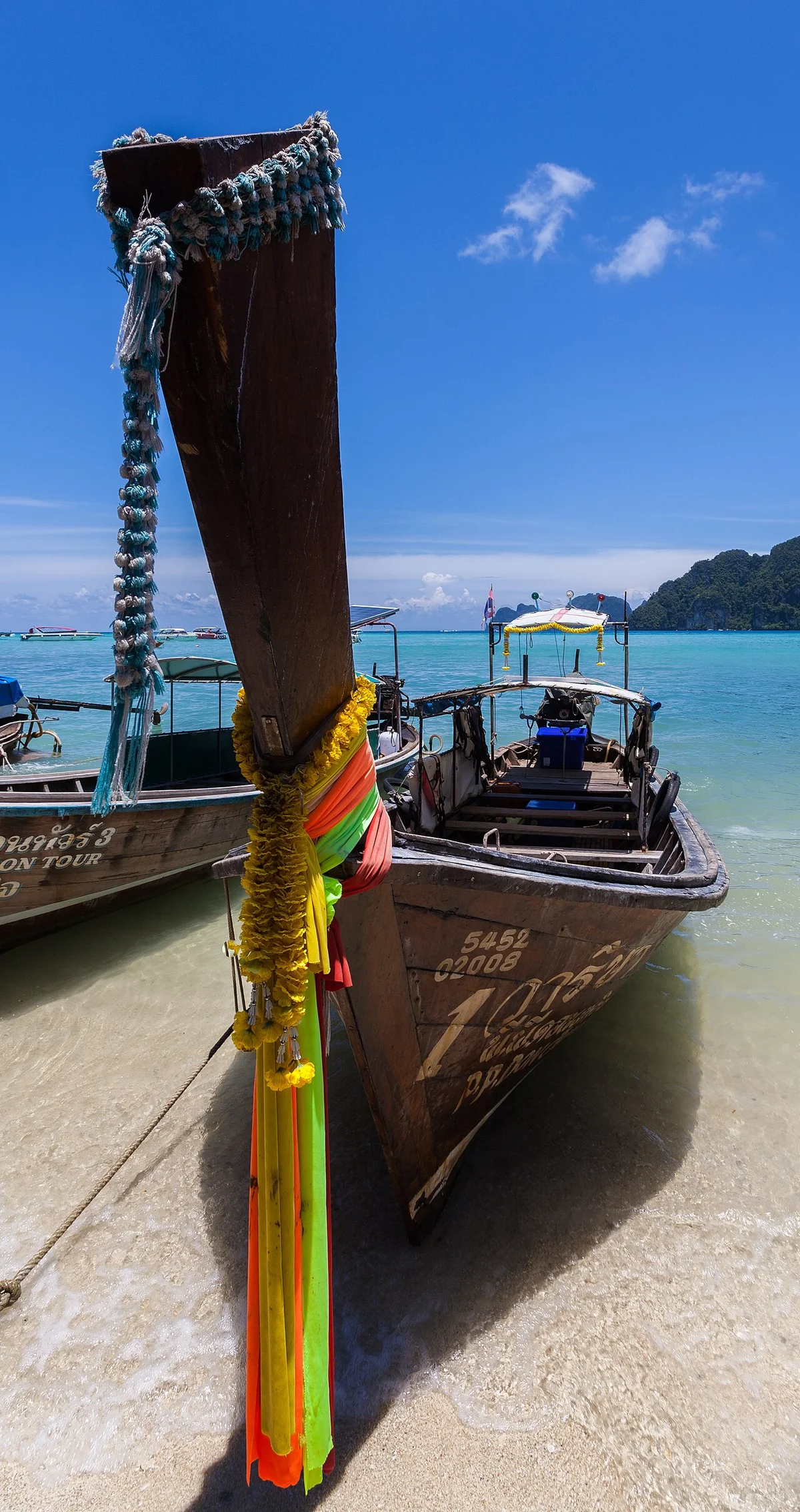
Phi Phi Don, the only island with permanent inhabitants and possessing the largest area in the archipelago, acts as the central transit station for all accommodation activities and travel itinerary distribution. The topographical structure of Phi Phi Don is characterized by a narrow sand isthmus connecting two large limestone mountain masses at both ends, forming Loh Dalum Bay to the north and Tonsai Bay to the south. Tonsai Bay area concentrates the main pier system, where boats anchor and drop off/pick up passengers, and is also a commercial center with dense logistics services, restaurants, and accommodation facilities. Conversely, Loh Dalum Bay possesses a long shallow sandy beach, calm water, very suitable for coastal landscape approach activities but clearly affected by tidal regimes with receding water far from shore in the afternoon. Exploring Phi Phi Don requires visitors to travel overland via narrow concrete trail systems or use traditional longtail boats to navigate around rugged rocky capes to reach isolated beaches like Long Beach or Wang Long Bay.
Moving south about several kilometers is Phi Phi Leh, an uninhabited island famous globally thanks to the combination of rugged geomorphology and pristine marine ecosystems. The focal point of Phi Phi Leh is Maya Bay, a semicircular marine valley enclosed by towering limestone walls on three sides, creating a sheltered space with crystal-clear turquoise water. The management history of Maya Bay has undergone decisive turning points since the Thai government applied ecological restoration closure measures from 2018 to regenerate coral reefs severely damaged by tourist overload in decades prior. Currently, Maya Bay access regulations are extremely strictly controlled, including banning boats from directly entering the main bay, forcing vessels to anchor at floating piers at the back of the island in Loh Sama Bay, and requiring visitors to walk through an eco-wooden trail system through pristine rainforest to reach the sandy beach.
The journey to access Maya Bay begins with boats moving around the eastern cape of Phi Phi Leh to dock at Loh Sama, a small bay with rugged terrain featuring underground caves and vertical cliffs. From the floating pier at Loh Sama, visitors step onto wooden walkways designed to float above ground to protect native vegetation and humus layers from erosion. The trail, about two hundred meters long, leads through sea almond canopies and native greenery before opening up panoramic views of Maya Bay from behind. Here, direct swimming was once strictly limited and is now only permitted for knee-deep wading in clearly regulated areas to avoid disturbing fine sand layers and prevent negative impacts on the regeneration of blacktip reef shark populations and marine life returning to spawn.
Leaving Maya Bay, the itinerary continues taking visitors to Pileh Lagoon, a natural lagoon located deep within the limestone mountain mass of Phi Phi Leh Island. Pileh Lagoon is likened to a giant swimming pool in the open sea thanks to the enclosed limestone arc surrounding a shallow water area with colors changing continuously from turquoise to dark blue depending on the sunlight angle. The optimal experience of Pileh Lagoon uses local traditional longtail boats traveling deep into the lagoon, where visitors can clearly observe millions of years of sedimentary geological layers on cliff faces and participate in swimming in water with ideal salinity and temperature. Nearby is Viking Cave, a large limestone cave featuring ancient painting relics depicting ancient maritime-style sailing ships, while serving as a commercial swiftlet nest harvesting site under strict control of the Thai royal family.
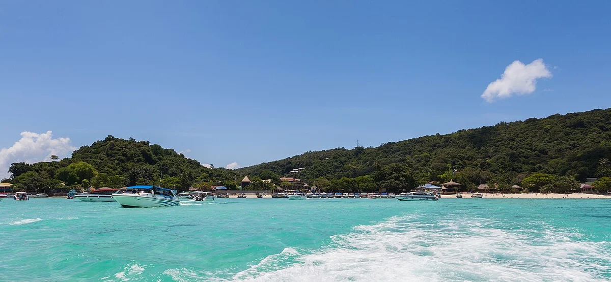
The underwater ecosystem in the Phi Phi Islands also plays an inseparable component in the experiential landscape structure, with international-standard snorkeling and scuba diving spots. The area around Bida Nok and Bida Nai islands, located south of Phi Phi Leh, is the preferred habitat of hard corals of the genus Acropora and colorful soft coral reefs, providing habitats for hundreds of reef fish species such as parrotfish, wrasses, along with frequent appearances of blacktip reef sharks. Diving here requires strict adherence to marine ecological conservation principles, absolutely no touching corals, no feeding wildlife, and no plastic littering to maintain the fragile balance of the ocean ecosystem in the national conservation area.
The optimal travel itinerary for a comprehensive survey of the Phi Phi Islands is usually designed according to a timetable synchronized with tidal conditions and solar radiation intensity during the day. Expeditions typically depart early in the morning to catch the best natural light at Maya Bay before tourist crowds gather during peak midday hours. After completing the walk through the Loh Sama ecological trail and visiting Maya Bay, the journey continues toward Pileh Lagoon for swimming and a light lunch on board, before moving to the northern area of Phi Phi Don to dive at shallow coral reefs in the afternoon. Arranging stopover sequences in a closed circle saves fuel for transport vehicles, minimizes waterway traffic pressure at narrow bay mouths, and provides participants with a scientific, comprehensive view of geomorphological structures as well as ecological restoration efforts underway in one of Asia’s most famous archipelagos.
The Phi Phi Islands, an archipelago belonging to Krabi province in southern Thailand, comprise two main islands, Phi Phi Don and Phi Phi Leh, along with several surrounding small limestone islands, creating a specific geographical space for the development of island marine service ecosystems. Anthropologically, this area was historically inhabited by Muslim communities, primarily ethnic Malay fishermen migrated centuries ago, making a living through coastal fishing and cage aquaculture. When the mass tourism wave began shifting strongly in the late twentieth century, the socio-economic structure of the archipelago underwent a major transformation from a pure marine agricultural economic model to a complex tourism service economy. This transition entailed the formation of a rich ecosystem of services, utilities, and indigenous cultural spaces, reflecting the intersection between long-standing fishing traditions and the demand to serve international tourists with high density year-round.
The center of service activities and community life focuses on Phi Phi Don Island, especially the narrow sand isthmus connecting two large limestone mountain masses, which forms residential areas, local markets, restaurants, accommodations, and public utilities. Indigenous residents here maintain a lifestyle tied to southern Thai Muslim culture, reflected through traditional housing architecture, Halal food markets, and the presence of local mosques. Community interaction spaces here revolve not only around commercial activities serving tourists but also preserve religious practices and traditional festivals of indigenous fishing communities. Despite enormous pressure from the smokeless industry, generations of native residents preserve core cultural values, creating a distinctive cultural stratum alongside modern tourism services currently dominating the landscape space.
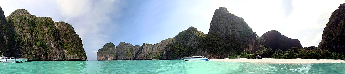
The system of cultural experience and entertainment services in the Phi Phi Islands reflects the quick adaptation of local people to global tourist preferences. Diving services, kayaking, and island tours by traditional longtail boats are operated by local fishermen themselves, helping to maintain stable income sources for the community.
The Phi Phi Islands, a faulted limestone island terrain complex in the Andaman Sea, about forty kilometers southeast of Krabi province’s coastline and an equivalent distance southwest of Phuket, require extremely rigorous and systematic field preparation from visitors. Geological formation from ancient coral reefs uplifted over millions of years has created vertical limestone cliffs, underground caves, and shallow bay systems with special ecological sensitivity. To access this archipelago safely and minimize negative impacts on the natural environment already under overloading pressure from mass tourism, mastering timelines, hydro-meteorological conditions, maritime methods, and strict legal regulations is a prerequisite for any research or sightseeing journey.
To fully experience this journey with a local guide, you can refer to the Bangkok – Pattaya 5 Days 4 Nights Tour with a pre-arranged itinerary.