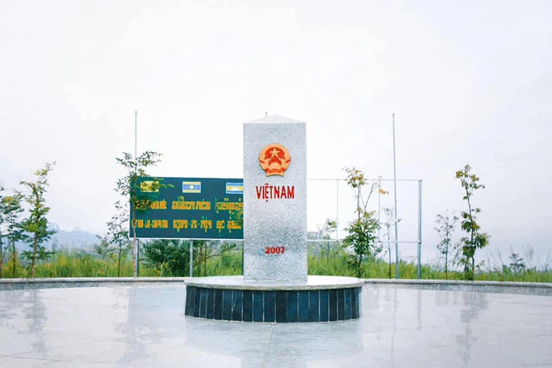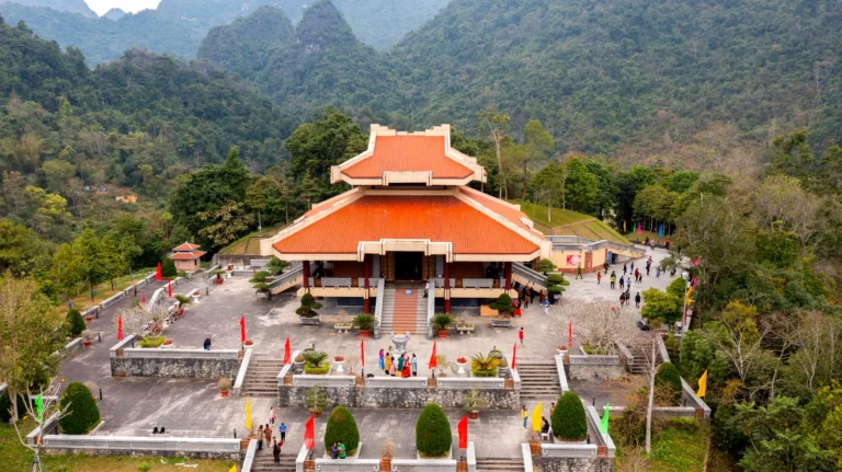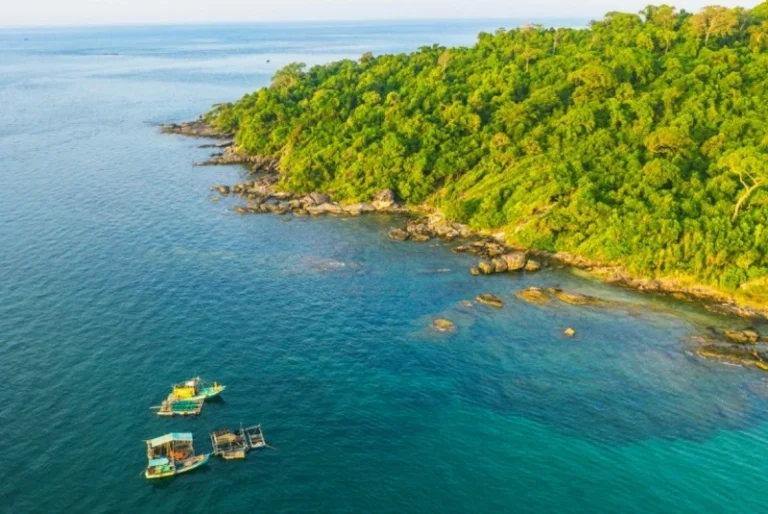
Nestled deep within the majestic Truong Son mountain range, where the resonant chimes of gongs echo alongside the gentle rhythm of the legendary Po Ko River, the Indochina Tri-Border Landmark in Bo Y Commune, Ngoc Hoi District, Kon Tum Province stands as a sacred symbol of friendship, solidarity, and national sovereignty. Situated at a unique geographical intersection at an altitude of nearly 1,000 meters above sea level, this place is famously described as where “a single rooster’s crow echoes across three countries,” marking the meeting point of the sovereign territories of three neighboring nations: Vietnam, Laos, and Cambodia. From a feng shui perspective, this border tripoint is a grand nexus of natural energy in the Central Highlands, where the western Truong Son range cradles mist-shrouded valleys, creating a landscape that is both rugged and majestic, steeped in the sacred spirit of the mountains and rivers.
Stepping back in time, this indigenous region has for millennia been the ancestral homeland of ethnic groups belonging to the Mon-Khmer and Austronesian language families, such as the Xo Dang, Gie Trieng, Brau, and Ro Mam. Ancient archaeological relics prove that this area once served as a vital hidden artery along the legendary “Salt Road” and a bustling trade route for forest products, closely linking the Central Highlands with the lower Mekong River basin and the sun-drenched, windswept central coast. Under feudal dynasties from the Ly and Tran to the Early Le, this frontier strip acted as the western bulwark of the Fatherland. By the Revival Le and Nguyen dynasties—particularly under Emperors Minh Mang, Thieu Tri, and Tu Duc—the Hue imperial court gradually implemented the “tho quan” (native chieftain) policy and established a system of border patrol stations, transforming the area into a crucial strategic buffer zone for national defense and diplomatic relations with the neighboring kingdoms of Lan Xang (Ai Lao) and Cambodia (Chan Lap).
Through the tides of history, when the French established colonial rule over the Indochinese Peninsula, expeditions along the Mekong River alongside legal treaties initially sketched out the colonial boundaries. However, it was not until the modern era that a truly monumental historical milestone was engraved, when construction on the common tri-border landmark of the three countries officially commenced on October 29, 2008, and was inaugurated on January 18, 2009. Crafted from granite in the shape of a triangular prism facing three directions—each bearing the national emblem and name of Vietnam, Laos, or Cambodia—this architectural work not only marks a brilliant achievement in land border demarcation and marker planting, but also embodies a shared commitment to peace and mutual respect for independence, sovereignty, and territorial integrity.
Seen through the lens of heritage studies and contemporary journalism, conquering the Indochina Tri-Border Landmark is not merely a journey to explore geology and picturesque mountain scenery, but also a pilgrimage back to cultural and historical roots. This place preserves the heroic spirit of the renowned generals of the Nguyen Dynasty who guarded the frontier day and night, alongside legends of local chieftains and village elders who held fast to the land and forests. Amidst the drifting clouds and mountain winds of Kon Tum, the landmark stands tall as an enduring historical witness, nurturing national pride and the vibrant vitality of Vietnamese cultural heritage on the path of integration and development.
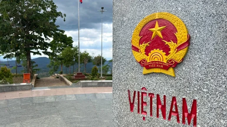
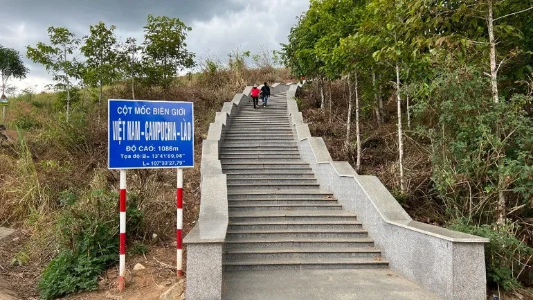
Standing majestically atop Ngoc Can Peak at an elevation of over 1,000 meters above sea level, the Indochina Tri-Border Landmark rises as a proud symbol of friendship and national sovereignty. Commandingly positioned in an auspicious “backed by mountains, facing water” setting, the monument is enveloped by the vast Truong Son wilderness, where drifting clouds blanket the peaks year-round to paint a breathtaking, pristine, and enchanting natural panorama. From the very first steps ascending hundreds of natural stone stairs winding up the hillside, visitors can distinctly feel the crisp shift of the highland climate, breathing in pure air lightly scented with earth, sky, and primeval forest leaves.
In terms of architecture and sculptural artistry, the shared border marker of Vietnam, Laos, and Cambodia is a work rich in diplomatic significance and refined aesthetics. Carved from a massive, time-enduring block of granite, the monument takes the form of an imposing triangular pillar, with each face oriented toward one of the three nations and inscribed with its national emblem and country name, deeply engraved and gilded in solemn, sharp detail. The apex rises like an eternal arrow planted firmly into the motherland, affirming inviolable sovereignty. Every carved line and edge of the stone reflects meticulous precision in border-monument engineering, while blending seamlessly with the deep green surroundings to create an architectural ensemble that is both dignified and in harmony with nature.
To capture extraordinary artistic moments at this frontier landmark, photographers and seasoned travel journalists often share their most prized camera angles. The first and most sought-after photo spot is from the wide courtyard directly in front of the main face of the monument, using a wide-angle lens to frame the imposing granite pillar against the boundless sky behind it. The second angle lies slightly higher up the slope looking diagonally downward, allowing the photographer to capture the sprawling expanse of the border forest as a backdrop, lending epic depth to the shot. Most notably, the ideal lighting of the day occurs at early dawn just as the sun breaks over the horizon, or at dusk as sunset descends. During these golden hours, radiant sunbeams pierce through wisps of lingering mist, illuminating the granite monument, bringing the gilded national emblems to life, and casting an ethereal, sacred beauty that defies description.
Setting foot at the Indochina Tri-Border Landmark in Bo Y Commune, Ngoc Hoi District, Kon Tum Province, visitors not only lay hands on a monument of profound historical and diplomatic importance, but also embark on an emotionally stirring journey. The road leading up to the marker winds around gentle hillsides embraced by the endless emerald expanse of the Central Highlands. Climbing hundreds of sturdy stone steps amidst brisk mountain breezes delivers an indescribable rush of exhilaration. Every footstep beats in sync with the pulse of the frontier wilderness, where crisp, pure air brushes through your hair and washes away all the hustle and bustle of urban life.
Standing directly before the triangular granite pillar, engraved with the national emblems of Vietnam, Laos, and Cambodia facing their respective territories, an overwhelming wave of awe and pride surges through your chest. From over 1,000 meters above sea level, casting your gaze into the distance reveals mountain peaks, winding streams, and vast primeval forests converging in a wide, open expanse. Standing at the crossroads where “one rooster crows and three countries hear” inspires deep reflection on the friendship and enduring bond among the three neighboring peoples, while reminding today’s generation of the sacred value of peace, independence, and sovereignty.
Descending from the sacred peak, the journey through the tri-border region continues with vibrant indigenous cultural experiences. Guided by the local Xo Dang and Gie Trieng people, travelers have the chance to visit traditional villages tucked along the hillsides and listen to the heroic resonance of gongs echoing beneath towering communal Rong houses. Even more delightful is savoring renowned highland specialties bursting with forest flavors—fragrant bamboo-tube sticky rice (com lam), open-fire grilled chicken dipped in spicy lemon-basil salt (muoi e), and warm sips of traditional jar wine (ruou can) shared in heartfelt hospitality. All of these priceless firsthand experiences—from majestic natural landscapes and unique cultural intersections to warm local hospitality—leave travelers with unforgettable impressions of a legendary, vibrant frontier land.
Located on a border mountain ridge in Bo Y Commune, Ngoc Hoi District, Kon Tum Province, the Indochina Tri-Border Landmark is a sacred destination drawing large numbers of domestic and international visitors alike. To ensure a smooth and fulfilling exploration, this handy pocket guide provides the most practical information on visiting hours, costs, routes, and essential tips when setting foot in the land where “a single rooster’s crow echoes across three countries.”
Regarding operating hours, the landmark area is open to visitors year-round during the administrative working hours of the border guard forces, typically from early morning until late afternoon. Travelers are advised to set out in the morning to allow ample time for travel, registration procedures, and taking in the sweeping scenery. The best time of year to visit is during the dry season, from November to April of the following year, when the weather is dry with little rain and clear skies—ideal for climbing the stone steps and capturing commemorative photos.
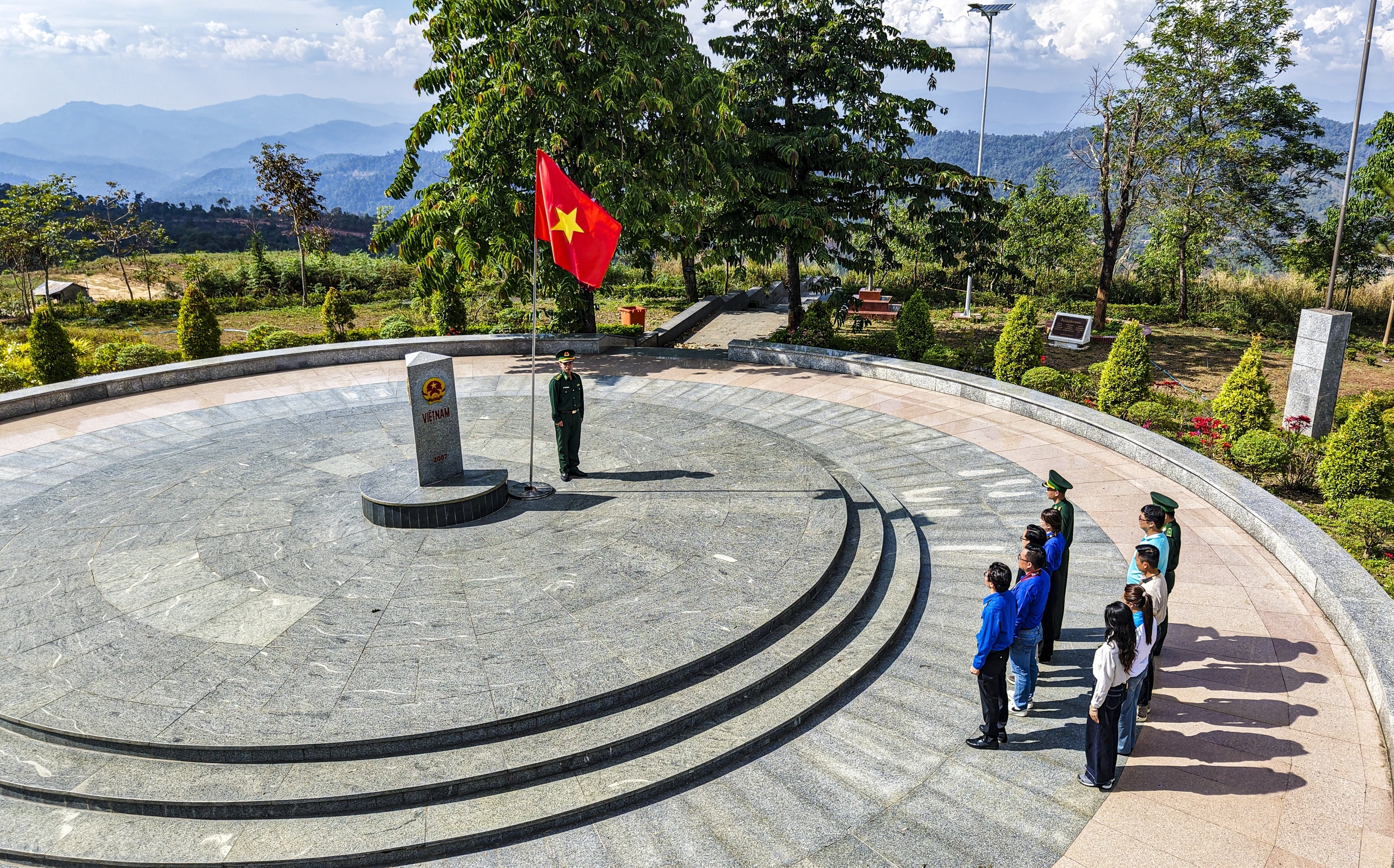
Great news for all travelers is that visiting the Indochina Tri-Border Landmark is completely free of charge, with no entrance fee required. However, because this is a special national border zone, visitors must contact and complete mandatory registration procedures at the Bo Y International Border Gate Guard Station before ascending to the marker to ensure full compliance with legal regulations.
To get there, starting from central Kon Tum City, follow National Highway 14 toward Ngoc Hoi District for a distance of just over 70 km. Upon reaching Plei Kan Town (Ngoc Hoi), turn onto the road heading toward the Bo Y International Border Gate and follow the signposts leading up the border patrol road. The best vehicles for tackling this route are motorbikes or high-clearance cars, as the mountain road winds steeply with sharp hairpin turns that require steady driving skills and a well-maintained vehicle.
Given the high mountain terrain, numerous steps, and sensitive border-zone status, visitors should wear neat, respectful attire, prioritizing comfortable clothing and grippy athletic shoes for navigating the stone stairs safely. Be sure to bring valid personal identification (such as a Citizen ID card or passport), strictly follow all instructions from the border guards on duty, refrain completely from filming or photographing restricted areas, and help maintain cleanliness while respecting the natural landscape of this sacred tri-border landmark of the Fatherland.
To enjoy a seamless getaway and take in the full beauty of the Indochina Tri-Border Landmark without worrying about transportation, permits, or itinerary planning, travelers can opt for VDS Travel’s premium all-inclusive Kon Tum tour packages. Every itinerary is thoughtfully timed for photo check-ins when the scenery is at its most radiant, accompanied by knowledgeable local guides well versed in regional culture alongside top-tier hotel and dining standards.