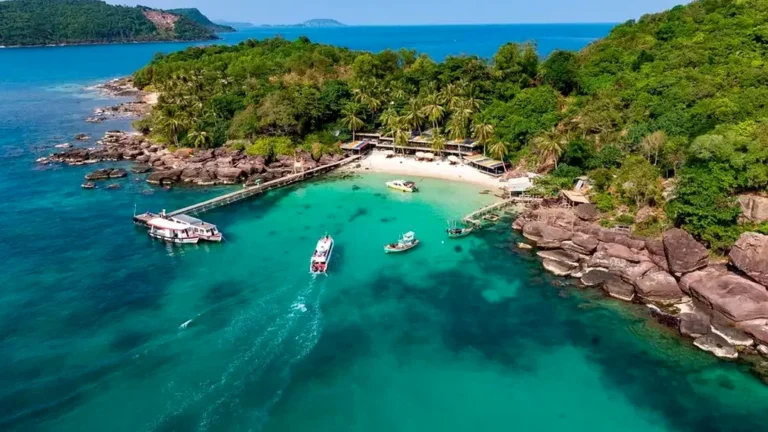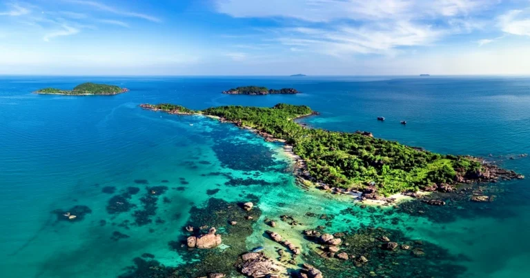
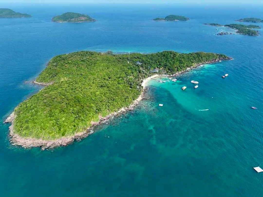
Tucked quietly away at the southernmost tip of the An Thoi Archipelago—within the waters of Hon Thom Commune, Phu Quoc City, Kien Giang Province—Hon May Rut stands out as a singular destination where natural wonders converge with deep-rooted cultural heritage. Centered at approximately 9°50′ to 9°52′ North latitude and 104°00′ to 104°02′ East longitude, the island serves as a natural outpost amid the vast waters of the Gulf of Thailand. From a geological perspective, Hon May Rut features a domed granite crust sculpted by tens of thousands of years of relentless wave erosion, dating back to the Quaternary Period (Pleistocene–Holocene). Natural weathering and denudation have carved out a distinctive system of marine terraces, brooding sheer cliffs, and stretches of fine white crushed-coral sand along its southeastern and western shores, creating a rare, pristine island micro-ecosystem.
Beyond its distinctive geology, traditional Eastern geomancy (feng shui) places Hon May Rut in an exceptionally auspicious position. Eastern geographers liken the An Thoi waters in general—and the Hon May Rut sub-region in particular—to the formations of “School of Fish Contending” combined with “Nine Dragons Paying Homage to the Origin,” where nine lines of vital energy converge toward the center. Anchoring the southern arc, the island rests securely against satellite islets such as May Rut Trong and May Rut Ngoai, forming a sturdy natural screen against both the Northeast and Southwest monsoons. The terrain’s energy veins originate from the continental shelf, traverse the Southwestern fault line and the Phu Quoc system, knot together at An Thoi, and gather on these outer islands. The classic “Coiling Dragon, Crouching Tiger” landscape is clearly etched across the surrounding submerged reefs, enclosing tranquil “water-gathering basins” of crystal-clear, calm water that have sheltered fishermen for generations.
The name “May Rut” (literally “Receding Clouds”) also carries echoes of local folklore and dialect, evoking clouds drifting low to embrace the sea at twilight or first light. Nguyen Dynasty historical records—such as Dai Nam Thuc Luc (Veritable Records of Dai Nam), Dai Nam Nhat Thong Chi (Comprehensive Gazetteer of Dai Nam), and Kham Dinh Dai Nam Hoi Dien Su Le (Imperially Ordered Collected Statutes and Precedents of Dai Nam)—documented the southern waters of Phu Quoc and the An Thoi Archipelago as a vital fishing ground and a strategic frontier outpost along Dai Nam’s southwestern maritime border. Throughout centuries of land reclamation and maritime defense, Hon May Rut has borne the footprints of pioneering ancestors: courageous fishermen who ventured out to establish coastal settlements, royal naval patrols guarding the sea lanes, and spirited settlers who held fast to the sea to protect their homeland.
In the modern era, heritage management agencies, research institutes, and the media have recognized Hon May Rut as a premier destination for ecotourism and marine heritage conservation. The untouched beauty of swaying coconut palms, glass-clear water revealing the seabed below, and thriving coral reef ecosystems have transformed the island into a living open-air museum. Cherishing Hon May Rut is not merely about preserving a breathtaking scenic landmark; it is also a tribute to the profound historical and cultural legacy left behind by ancestors along the southern maritime frontier of Vietnam.
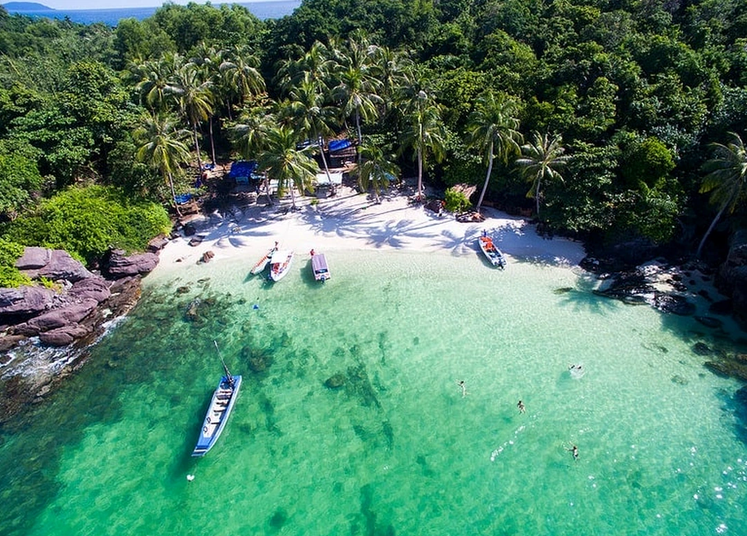
Hon May Rut rises like an oceanic sculpture, where the unseen hand of nature has chiseled towering granite formations dating back tens of millennia. Polished over centuries by wind, waves, and tides, the cliffs here are far more than inert rock—they take on dramatic shapes, with layered slabs stacked like ancient stairways reaching out into the open sea. At the foot of these sheer rock faces lies a ribbon of powdery white sand formed from millions of glittering coral fragments, creating a rich visual contrast between the deep azure ocean, the somber gray of primordial stone, and the pure white of the bay’s shoreline. Gently curving contours paired with calm, jade-green coves turn Hon May Rut into a vivid, breathtaking natural tableau where majestic grandeur meets poetic serenity.
To capture the island’s extraordinary beauty through the lens, professional photographers and leading travel publications frequently recommend two iconic vantage points. The first photo spot is located on the southwestern rocky headland, where tiered granite slabs jut out over the sea to form a dramatic natural observation deck. The ideal lighting here occurs at sunset, as the sun dips slowly toward the horizon, painting a corner of the An Thoi sea in fiery crimson and casting golden rays across the ancient stone for a dreamlike, cinematic scene. The second vantage point sits right along the crushed-coral beach on the southeastern side, where the water is so transparent you can see submerged coral reefs swaying with the rhythm of the currents.
The most magical window for shooting this second location is at dawn, when the first rays of morning light pierce the thin sea mist and illuminate the quiet shore with pure, elemental energy. Choosing the right timing and angle does more than reward content creators and travelers with artistic, viral-worthy photographs—it offers a journey into the soul of a natural heritage site, where every frame holds the breath of time and millions of years of geological history in Vietnam’s southwestern seas.
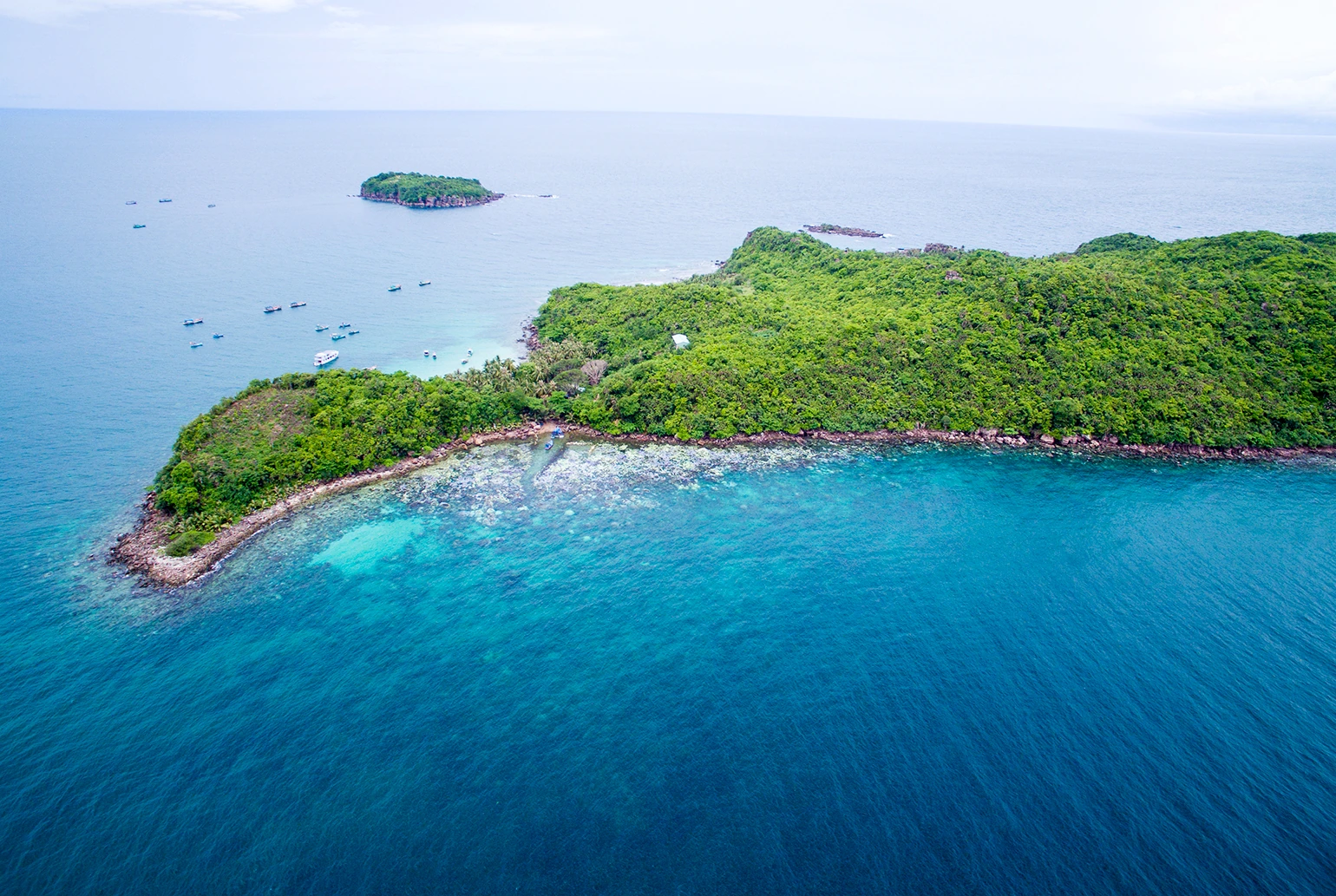
Stepping onto Hon May Rut, visitors are immediately drawn into an immersive, hands-on adventure where untamed nature blends seamlessly with an authentic coastal way of life. From the very first steps, clambering up the ancient granite cliffs delivers an indescribable sense of awe. Scaling million-year-old outcrops worn into fantastical shapes by the sea not only tests your agility, it lets you feel the pulse of time etched into every sedimentary layer. Upon reaching the island’s highest vantage point and gazing out in every direction, the entire sweep of the An Thoi Archipelago unfolds before your eyes: on one side, transparent emerald waters reveal vibrant coral gardens beneath the surface; on the other, islands large and small rise across the open sea, composing a priceless natural masterpiece bestowed upon southern Vietnam.
Leaving the rugged cliffs behind, the journey continues with a boat ride gliding along the gentle swell to take in the peaceful beauty of the island’s sheltered lagoons. Seated aboard a rustic wooden boat operated by local fishermen, you drift into a realm of absolute tranquility, broken only by the soft rustle of wind through coconut fronds and the gentle lapping of waves against the fine sand. Pausing at sacred corners of the island—where locals have erected small shrines to honor the pioneers who settled these waters—every traveler feels a quiet sense of reverence. This harmony between local spiritual traditions and natural majesty radiates a soothing energy that washes away the hustle and stress of modern city life.
No visit to Hon May Rut is complete without a culinary celebration of Kien Giang’s renowned island specialties. Seated on soft white sand beneath cool coconut shade, travelers can savor freshly caught treasures straight from the sea: fragrant grilled sea urchin with scallion oil, rich sweet-and-sour cobia hotpot, or herring salad wrapped in rice paper with wild forest herbs and dipped in authentic Phu Quoc first-press fish sauce. The richness of fresh seafood paired with the sharp warmth of chili and pepper and the briny essence of the ocean awakens every sense, leaving an unforgettable impression. Hon May Rut is thus far more than a site of geological interest—it is a living tapestry of memories that touches the heart of everyone who sets foot on its shores.
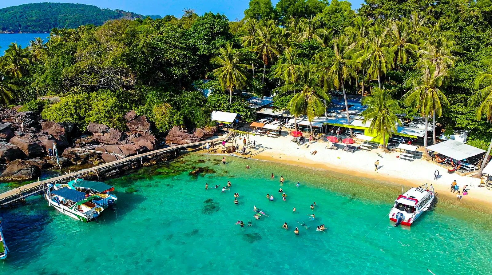
To welcome travelers exploring the wild landscapes and historical heritage of Hon May Rut, local heritage and tourism authorities have updated detailed visitor guidelines to ensure a rewarding and safe experience.
Regarding operating hours, Hon May Rut is open for self-guided visits daily from 6:00 AM to 5:30 PM. However, the best time of year to visit the island is from November to April. This coincides with southern Vietnam’s dry season, bringing calm seas, gentle waves, and clear skies—ideal conditions for boat transfers, swimming, snorkeling over coral reefs, and exploring the island’s geology and scenery.
Currently, Hon May Rut charges no fixed entrance or admission fee, allowing visitors to freely explore its unspoiled natural landscapes. Expenses primarily come from hiring a speedboat or tourist boat to reach the island. To get there from central Phu Quoc (Duong Dong), travel south along the main arterial road to An Thoi Port (approximately 25–30 km). From An Thoi Port, charter a speedboat or tour boat across the waves to Hon May Rut—a quick 15-to-20-minute ride that doubles as a scenic cruise across the picturesque bay.
Because the terrain features sheer granite cliffs, crushed-coral beaches, and sites of spiritual and cultural significance, visitors should dress appropriately. Opt for lightweight, breathable clothing along with high-traction athletic sneakers or dedicated water shoes to navigate the rocky outcrops safely. At the same time, please dress modestly and respectfully when visiting sacred shrines, maintain cleanliness, and never litter, helping preserve this fragile island ecosystem and sustainable heritage landscape for future generations.
To enjoy a seamless getaway and experience the full splendor of Hon May Rut without worrying about transportation, tickets, or itinerary logistics, travelers can choose from VDS Travel’s premium all-inclusive Phu Quoc tour packages. Each itinerary is thoughtfully timed so you arrive at photo spots when the scenery is at its most radiant, accompanied by knowledgeable local guides and top-tier hotel and dining standards.